More From Contributor
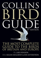
£10.99
Map No. 124, Colline di Rimini, in a series of GPS compatible hiking maps at 1:50, 000 from the Istituto Geografico Adriatico, covering parts of central Italy: eastern Tuscany, with northern Umbria & the Marches, plus the south-eastern of part of Emilia-Romagna. This title covers the holiday resorts on the Adriatic coast around Rimini, Riccione & Cattolica, extending inland to include Sam Marino & Urbino. Maps in this series have contours at 50m intervals with additional shading & numerous spot heights. Colouring indicates different types of land use, including woodlands, olive groves, vineyards & orchards. National park & protected areas are marked. An overprint highlights local waymarked hiking routes, indicating their official number or name, including many long-distance routes such GEA (Grande Escursione Appeninica) & the course of the E1 cross-European footpath. Most titles also show cycle routes and/or mountain bike trails. A range of symbols indicate various facilities such as campsites, mountain refuges & other rural accommodation, bars & restaurants, sport & recreational places, historical & cultural monuments, etc. Road network is graded according to width,

Includes::
country tracks, & shows sections closed to motorised traffic plus locations of petrol stations. The maps have a 5km UTM, plus latitude & longitude lines at intervals of 5’. Map legend

Includes::
English. * * Please note: titles shown on the accompanying grid in broken lines are not yet published.*


...
Archived Product
£10.99
Bologna with its southern environs, including the San Luca Hills, on a contoured & GPS compatible map at 1:25, 000 from L` Escursionista Editore highlighting waymarked walking trails & other local paths, not signposted but open to hikers. An inset extends the coverage north of the city to show the route along the Canale Navile. Topography is presented by contours at 20m intervals with relief shading & colouring indicating orchards & woodlands, plus boundaries of protected areas. Waymarked trails are shown with their route numbers, & the map also highlights other hiking routes open to the general public, indicating points where access may be closed as the path crosses private property. The map has a 1km UTM grid. Map legend

Includes::
English. The map comes with a 50-page booklet, in Italian only, describing the area & its sights.

...
Archived Product
£8.99
Double-sided, indexed street plan of Collingwood
- Owen Sound. Street plans from the Map Art / Canadian Cartographics Corporation
...
Archived Product
£11.99
The ultimate 3.2 miles to 1 scale large format atlas for the year 2011, featuring Collins well established mapping; designed for exceptional clarity & ease of use.

Includes::
a wide range of urban area maps at larger scale plus 56 town centre street plans. Now with speed limits shown at speed camera locations. With lie-flat spiral binding. This fully updated road mapping covers the whole of Britain with each scale of mapping colour-coded for ease of use. The smallest scale maps are great for long distance route planning & the street plans help you locate your final destination. The atlas
Includes:: / Fully updated fixed speed camera sites with average speed camera locations clearly highlighted. All speed cameras show the speed limit. / Route planning section including maps (16 miles to 1 inch) for long distance route planning, motorway services information & a handy distance calculator. / Easy to use, clear road maps at a scale of 3.2 miles to 1 inch (1:200, 000) of Engl&, Wales & Southern Scotl&. Northern Scotland is shown at 5 miles to 1 inch (1:316, 800)./ 21 urban area approach maps at 1 mile to 1 inch which clearly show the best routes through & into the busiest built-up areas. / 56 street maps focussed on town centres showing places of interest, car park locations & one-way streets. / World Heritage Sites located with contact details & brief descriptions. / Over 30 categories of places of interest including castles, theme parks, sports venues, universities, mountain bike trails & surfing beaches. / Park & Ride locations shown, ideal when visiting towns & cities. / Full postcodes for the top 1000 places of interest; ideal to be used alongside satnav systems.


...
Archived Product
£11.99
Britain in an A3 spiral bound 2012 road atlas from Collins, with road maps of Engl&, Wales & Southern Scotland at 3.2 miles to 1 inch (1:200, 000), & Northern Scotland at 5 miles to 1 inch (1:316, 800). There are also urban area maps at larger scales, & 56 detailed town centre street plans. Cartography shows all motorways & major roads, with clear indication of carriageway type, minor roads & road distances are shown in miles. Fixed speed camera sites with roads covered by average-speed cameras are clearly highlighted. Locations of alternative fuel sites (LPG, Biodiesel, Bioethanol, Natural Gas & Electricity recharging points) as supplied by the Energy Saving Trust. Railway lines & stops are marked, as are airports. Points of interest such as historical landmarks, tourist sites, sports facilities & camp sites are clearly indicated; administrative boundaries are marked. Spot heights show topography.A route planning section

Includes::
maps for long distance route planning, motorway services information & a handy distance calculator chart. The 21 urban area approach maps are at 1:62, 500 showing routes through & into built-up-areas. Street maps focused on town centres show one-way streets, car parks, & places of interest. The top 1000 most visited places of interest are indexed with full postcodes to aid integration with sat-nav systems.

...
Archived Product
£30.00
A unique beginner`s guide to bird song with 3 CDs of crystal-clear digital recordings & a comprehensive guide to identifying more complex songs & calls. The new Collins Bird Songs & Calls

Includes::
re-recorded versions of the original habitat CDs
- ensuring that they are even clearer, but just as atmospheric
- introducing the user to the major bird habitats of Britain & the birds that live in them. This new edition also features a third CD containing a unique guide to identifying more complex songs & calls, with tips on what aspects of the song or call are the distinguishing characteristics. Beginning with simple, similar-sounding songs, it gradually moves through more difficult distinctions & on to a comprehensive section on passerine calls. Species that often occur in the same habitat are treated together. An accompanying full-colour guide explores the historical background to how recordings of bird songs & calls have developed & been appreciated over the years along with species accounts of the behaviour of all of our common birds. Collins Bird Songs & Calls will help you to quickly appreciate the wonderful range of bird voices & discover just what bird song is all about. A walk in the park will never be the same again.


...
Archived Product
£12.99
To aid specific identification, information on bird behaviour, song, nesting, food, habitat & prevalent features is included. 230 subspecies are illustrated in the habitat where they may have been seen, showing seasonal, sexual & juvenile plumage variations. ...
Archived Product
£19.99
In a unique new collaboration, Collins have paired up with the respected British Trust for Ornithology, bringing together the most authoritative & up-to-date information in this new field guide to the common birds of Britain & Irel&. This unique new identification guide features all of the birds that have occurred five or more times in Britain & Irel&, including all species that breed regularly in the region, plus those that winter here, or occur as common passage migrants. The book has been written & illustrated as much with the beginner in mind as the experienced birdwatcher. Designed to be used in the field, the text & photographs describe & illustrate the key features needed to identify a species with complete confidence, & to separate it from similar, or `confusion`, species. As a general rule, the species accounts follow the taxonomic running order provided by the British Ornithologist`s Union (BOU). But for the benefit of the reader, in some instances the running order has been juggled subtly so that potentially confusing species are placed side by side. Throughout the book there are special pages that describe the key features needed for separating different families, & groups of birds that share the same habitat. More than 1, 200 photographs are featured & many are seen here for the first time. They have been chosen carefully to show not only important identification features but also to give clues to the usual habitat favoured by the bird, & its typical posture. Annotations highlight key identification features that are discussed in the text. Song & call are useful aids to identification, & reference is made to vocalisation for each species. The average size of each bird is included; in most species this is the length, measured from the tip of the bill to the tip of the tail, but in birds that are seen most frequently in flight (such as raptors), the given measurement is wingspan. Relative abundance maps are shown for every species. The darker shading shows where a species is most abundant, & the lighter shades where it is less so. These are based on the very latest information contained within the BTO`s Bird Atlas 2007-11. ...
Archived Product
£24.99
In a unique new collaboration, Collins have paired up with the respected British Trust for Ornithology, bringing together the most authoritative & up-to-date information in this new field guide to the rare birds of Britain & Irel&. This book is the companion volume to the Collins BTO Guide to British Birds. It covers all the rare & scarce birds that have occurred in Britain & Ireland five times or more, as of February 2015. ` The Rarest of the Rare` section lists all the species that have occurred fewer than five times; taken in combination, this means that every species of wild bird that has ever occurred in Britain is mentioned. Species descriptions comprise the bulk of the book, & the text & photographs describe & illustrate the key features needed to identify these birds with complete confidence. Confusion species are included, as are vocalisation details for species whose identification it aids. The photographs have been chosen carefully to show key features that are described in the accompanying text; they also give clues to the usual habitat favoured by the bird & its typical posture. Many of the photographs are seen here for the first time.`ID Key Feature` pages provide a quick guide to a group of species or families; they describe the structural & behavioural features that an observer should concentrate on initially when they come across an unfamiliar bird. Where relevant, these feature pages also highlight identification pitfalls. Unlike its companion volume, distribution maps are not included, as they are of little relevance when dealing with rare & scarce birds in Britain & Ireland: by their very nature, vagrant birds can turn up almost anywhere. However, where a part of Britain or Ireland is noteworthy for the occurrence of a given species, then the region in question is mentioned in the text. ...
Archived Product
£18.99
This classic guide to the butterflies of Britain & northern Europe enters its third edition as part of the authoritative Collins Guide series. This comprehensive guide to the butterflies of Britain & Europe features over 400 species, depicting both male & female insects. Species descriptions include details on taxonomic nomenclature, distribution, flight period, variation, habitat, behaviour & life cycle. Subspecies are included where there is significant variation, & distribution maps accompany each widespread species. Illustrated by Richard Lewington, the world`s leading butterfly illustrator, this is an ideal field guide for travelling naturalists & butterfly enthusiasts alike & is an essential addition to every nature lover`s bookshelves. ...
Archived Product

Collins Bird Guide

Following on from its hugely successful launch in 1999, Collins Bird Guide - the ultimate reference book for bird enthusiasts - now enters its second edition. With expanded text and additional colour illustrations, the second edition of the hugely successful Collins Bird Guide is a must for every birdwatcher. The book provides all the information needed to identify any species at any time of the year, covering size, habitat, range, identification and voice. Accompanying every species entry is a distribution map and illustrations showing the species in all the major plumages (male, female, immature, in flight, at rest, feeding: whatever is important). In addition, each group of birds includes an introduction which covers the major problems involved in identifying or observing
them: how to organise a sea watching trip, how to separate birds of prey in flight, which duck hybrids can be confused with which main species. These and many other common birdwatching questions are answered.The combination of definitive text, up-to-date distribution maps and superb illustrations, all in a single volume, makes this book the ultimate field guide, essential on every bookshelf and birdwatching trip.
RIP - This product is no longer available on our network. It was last seen on 25.09.2019

This page now acts as a permanent archive for this product. Add more information using the comments box below to ensure it can still be found by future generations.

Use our search facility to see if it is available from an alternative contributor.
  • External links may include paid for promotion
  • Availability: Out Of Stock
  • Supplier: Stanfords
  • SKU: 9780007267262
Availability: In Stock
£30.00

Product Description

Following on from its hugely successful launch in 1999, Collins Bird Guide
- the ultimate reference book for bird enthusiasts
- now enters its second edition. With expanded text & additional colour illustrations, the second edition of the hugely successful Collins Bird Guide is a must for every birdwatcher. The book provides all the information needed to identify any species at any time of the year, covering size, habitat, range, identification & voice. Accompanying every species entry is a distribution map & illustrations showing the species in all the major plumages (male, female, immature, in flight, at rest, feeding: whatever is important). In addition, each group of birds

Includes::
an introduction which covers the major problems involved in identifying or observing them: how to organise a sea watching trip, how to separate birds of prey in flight, which duck hybrids can be confused with which main species. These & many other common birdwatching questions are answered. The combination of definitive text, up-to-date distribution maps & superb illustrations, all in a single volume, makes this book the ultimate field guide, essential on every bookshelf & birdwatching trip.

Reviews/Comments

Add New

Intelligent Comparison

Oooops!
We couldn't find anything!
Perhaps this product's unique.... Or perhaps we are still looking for comparisons!
Click to bump this page and we'll hurry up.

Price History

Vouchers

No voucher codes found.
Do you know a voucher code for this product or supplier? Add it to Insights for others to use.

Facebook

Jargon Buster

Flight - The process of of an object moving through the air
Date - A day on a calendar
Date - A social activity whith a current or potential partner
Colour - The categorised spectrum of light visable to humans
Year - The time it takes the planet earth to orbit the sun. This takes around 365.25 days.
Size - is the measurement of how big an object is in space.
illustrations - Pictures typically in books and newspapers.
Year - 365 days (366 days in a leap year), the time taken for planet earth to make one full revolution around the sun.
Reference - To prove evidence with a back up source.
Combination - The process of two of more things being mixed or combined together.

Supplier Information

Stanfords
Stanfords was established in 1853 and opened their iconic Covent Garden flagship store in 1901. They have become the top retailer of maps, travel books and accessories in the UK and arguably offer the largest selection of maps and travel books worldwide. Famous names such as Captain Robert Falcon Scott, Ranulph Fiennes and Michael Palin have purchased from Stanfords. They now have a shop in Bristol and both stores together with other venues operate a calendar of events including talks, book signings and exhibitions. As a specialist map retailer, the map selection is comprehensive and includes road maps, street maps and walking maps from worldwide destinations, as well as a selection of world atlases and wall maps. Books include travel guides and travel literature. Stanfords also stock globes, from miniatures made of blue marble to magnificent floor-standing globes. The website features a selection of interesting articles on travel topics.
Page Updated: 2023-11-12 20:15:36

Community Generated Product Tags

Oh No! The productWIKI community hasn't generated any tags for this product yet!
Menu