More From Contributor
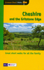
£35.00
This is a comprehensive guide to the buildings of Cheshire in all their variety, from Pennine villages to coastal plains & seaside resorts. Chester, the regional capital & cathedral city, is famous for its Roman walls & black-&-white timber architecture, its noble Neoclassical monuments, & its unique medieval shopping `rows` with their upper walkways. But Cheshire is also a major industrial county, with spectacular & internationally significant mills & canal structures. Specialist settlements include the famous railway borough of Crewe, the salt towns of Nantwich, Northwich & Middlewich, & Lord Leverhulme`s celebrated garden suburb at Port Sunlight. ...
Archived Product
£5.95
Cheshire in a series of colourful reproductions of attractive county maps by John Speede from about 1610-1611, printed on thick art paper & ideal for framing. Each title, 58 x 45cm / approx. 23” x 18”, is decorated with additional notes, drawings, coats of arms, street plans, etc. Little drawings are used to show locations of towns, larger villages, hills & woodlands or parks. Rivers & lakes are also drawn, as are boundaries of the administrative subdivisions with the names of the Hundreds. Surrounding the county are decorative panels filled with additional information which differs from title to title: street plans, coats of arms of notable local families, geographical features, notes about local history, etc. ...
Archived Product
£7.99
Cheshire & The Gritstone Edge in the Short Walks guide series, produced in association with Ordnance Survey & published by Crimson; comprising a range of walking guides to popular British destinations. Each title

Includes::
20 varied walks that are suitable for walkers of all ages & abilities & is accompanied by detailed Explorer 1:25, 000 Ordnance Survey mapping with colour-coded marked routes. The guides are structured in three main sections with different levels of difficulty- short & easy walks, those of modest length that may include uphill walking & more challenging routes that may be longer & over more rugged terrain- covering a total of 20 walks. Each walk has a mini summary & an information box with details of starting points, distance, approximate time, parking & any individual route features. There is also information on refreshments, local transport & public toilets en route. Appendices provide further useful information on walking safety, GPS, the Countryside Code, local organisations & Ordnance Survey maps.

...
Archived Product
£7.99
This is a collection of twenty circular walks designed for children & family groups which explore the local landscape & wildlife. It

Includes::
routes at Lymm, Alderley Edge, Little Budworth, Chester, Warmingham, Audlem & the Wirral, with maps & photographs.

...
Archived Product
£2.95
Cheshire 1610 Replica Map by the Old Map Company is a reproduction of the map created for the famous atlas of the period by the master map maker John Speede Esq. The Old Map Company has recreated the antique maps of British counties, European cities & World countries originally crafted by master map maker John Speede Esq. whose work had accuracy & quality not surpassed for centuries. Each map is treated & presented on specially crafted paper then h&-treated giving it texture & an aged appearance before being beautifully engraved & detailed. ...
Archived Product
£12.00
Jim Rubery’s Cicerone guide to Historic Walks in Cheshire explores some of the walking possibilities in one of the north-west’s most historic & popular counties. The guide

Includes::
walks through charming villages, famous stately homes, fascinating museums & through Chester itself, one of England’s most celebrated cities. The walking terrain varies from the wild, upland landscape of the Peak District to the riverside pastures & meadows of the Cheshire countryside. The guide is organized into 20 circular walks which explore every corner of the county & which range from canal-side strolls to rambles through wilder landscapes. Many of the routes are full of historic interest, combining landscape with architecture & natural beauty with history. Each walk has an information box providing details on total distances, start & finish points & the relevant map. Detailed route descriptions are accompanied by Ordnance Survey extracts mapping the route as well as colour photographs illustrating some of the main highlights of the region.

...
Archived Product
£14.99
Philip`s Street Atlas Cheshire gives detailed coverage of the county in a convenient spiral-bound format. The route planner shows all the A & B roads, & can be used when driving to get close to the destination before turning to the relevant large-scale street map. The street maps show every named road, street & lane very clearly, with major roads picked out in colour. The maps are at a standard scale of 3.5 inches to 1 mile. In addition, Chester city centre is shown at 7 inches to 1 mile. Other information on the maps

Includes::
postcode boundaries, car parks, railway & bus stations, post offices, schools, colleges, hospitals, police & fire stations, places of worship, leisure centres, footpaths & bridleways, camping & caravan sites, golf courses, & many other places of interest. Also included are fixed single & multiple speed-camera locations, with corresponding speed limits. The comprehensive index lists street names & postcodes, plus schools, hospitals, railway stations, shopping centres & other such features picked out in red, with other places of interest shown in blue. Philip`s Street Atlas Cheshire is suitable for both business & leisure use.

...
Archived Product
£11.95
Cheshire Ring & South Pennine Ring Pearson`s Canal Companion from Wayzgoose, showing over 165 miles of canal network including sections of the Ashton Canal, Bridgewater Canal, Calder & Hebble Navigation, Huddersfield Canals, Macclesfield Canal, Rochdale Canal, Peak Forest Canal, & Trent & Mersey Canal. Current edition of this title was published in May 2013. Pearson’s Canal Companions have for over 30 year now been presenting Britain’s network of inland waterways on handy size, informative guides which combine practical information with interesting descriptions & facts about the surrounding countryside. The routes are shown in sections on maps at approx. 2” to 1 mile, & are annotated with locks, towpaths & nearby facilities. Rather than providing a more technical picture of each waterway (depth, clearance, etc), these guides are indeed true “companions” with the accompanying descriptions full of interesting historical or literary references, little know facts, etc. Where appropriate the maps are also accompanied by recommendations for eating & drinking, shopping, things to do, & public transport connections. Each guide also

Includes::
a boating directory with hire bases, boatyards, ferries, etc. Please note: Pearson’s Canal Companions sometimes indicate facilities and/or places of interest without showing detailed road access to them; it’s perhaps advisable to use these charming companions with proper road maps of the surrounding countryside.

...
Archived Product
£11.99
Cheshire in the Pathfinder Guides series, produced in association with Ordnance Survey & published by Crimson; comprising a range of walking guides to popular British destinations. Each Pathfinder guide

Includes::
28 varied walks ranging from easy strolls to exhilarating hikes & is accompanied by 1:25, 000 Ordnance Survey mapping with marked, colour-coded routes. Introductory sections profile the county or region covered, with recommendations on the best time to visit & a brief explanation of GPS. An

...
Archived Product
£6.95
How many times do parents say If only my children were interested in walking? This beautifully-produced book of walks is aimed specifically at parents & children. Each walk

Includes::
easy-to-follow directions (for mums & dads) with instructions on where to point out interesting things that will fascinate young walkers
- everything from fir cones to wild flowers, church spires to squirrels. Some routes are suitable for pushchairs & these are clearly identified. All are on well-maintained paths that are easily negotiated by little people. Clear, concise, yet thorough directions are given, along with listings of toilets & baby changing facilities where available. The features a text of interest to children &

Includes::
unique 'check-lists' for each walk, for the child to tick off landmarks & objects encountered on the way. An Index Chart shows at a glance which walks are suitable for pushchairs, wet weather, which have a cafe or place of interest along route, & so forth, so that a perfect day out is planned in seconds.


...
Archived Product

Cheshire 1810-1843

Cheshire, an original antique map by G. Cole / J. Roper published in London, 1810-1843. Copperplate, coloured. Map size 23 x 17 cm, overall mounted size 38.5 x 32.5 cm.This detailed map of Cheshire is from Dugdale's England and Wales Delineated. The map was drawn by G. Cole and engraved by John Roper for publication first in The Beauties Of England And Wales, issued in parts, from c.1804. Such was the success of the publication that the maps were re-used in other publications, as here. The maps show accurate geographical detail, including the turnpike, mail coach and principal roads, sites of Roman and other historical remains, as well as the seats of the nobility and the gentry, and market towns with their distances from London. The maps also show the division of the counties
into hundreds or wapontakes. They are representative of the functional nineteenth-century approach to cartography, yet are not unattractive. Antique maps from various original publishers are presented on the Stanford
RIP - This product is no longer available on our network. It was last seen on 25.09.2019

This page now acts as a permanent archive for this product. Add more information using the comments box below to ensure it can still be found by future generations.

Use our search facility to see if it is available from an alternative contributor.
  • External links may include paid for promotion
  • Availability: Out Of Stock
  • Supplier: Stanfords
  • SKU: XL940891
Availability: In Stock
£80.00

Product Description

Cheshire, an original antique map by G. Cole / J. Roper published in London, 1810-1843. Copperplate, coloured. Map size 23 x 17 cm, overall mounted size 38.5 x 32.5 cm. This detailed map of Cheshire is from Dugdale's England & Wales Delineated. The map was drawn by G. Cole & engraved by John Roper for publication first in The Beauties Of England & Wales, issued in parts, from c.1804. Such was the success of the publication that the maps were re-used in other publications, as here. The maps show accurate geographical detail, including the turnpike, mail coach & principal roads, sites of Roman & other historical remains, as well as the seats of the nobility & the gentry, & market towns with their distances from London. The maps also show the division of the counties into hundreds or wapontakes. They are representative of the functional nineteenth-century approach to cartography, yet are not unattractive. Antique maps from various original publishers are presented on the Stanford

Reviews/Comments

Add New

Intelligent Comparison

Oooops!
We couldn't find anything!
Perhaps this product's unique.... Or perhaps we are still looking for comparisons!
Click to bump this page and we'll hurry up.

Price History

Vouchers

No voucher codes found.
Do you know a voucher code for this product or supplier? Add it to Insights for others to use.

Facebook

Jargon Buster

Cm - Centimetres, one centimetre is equal to 10 milimetres
antique - An old collectible item with desirable qualities.
England - A country within the United Kingdom.
Mail - Or post is a service for transmitting physical objects or letters between locations
Size - is the measurement of how big an object is in space.
Accurate - A measurement of precision when all elements are correct.

Supplier Information

Stanfords
Stanfords was established in 1853 and opened their iconic Covent Garden flagship store in 1901. They have become the top retailer of maps, travel books and accessories in the UK and arguably offer the largest selection of maps and travel books worldwide. Famous names such as Captain Robert Falcon Scott, Ranulph Fiennes and Michael Palin have purchased from Stanfords. They now have a shop in Bristol and both stores together with other venues operate a calendar of events including talks, book signings and exhibitions. As a specialist map retailer, the map selection is comprehensive and includes road maps, street maps and walking maps from worldwide destinations, as well as a selection of world atlases and wall maps. Books include travel guides and travel literature. Stanfords also stock globes, from miniatures made of blue marble to magnificent floor-standing globes. The website features a selection of interesting articles on travel topics.
Page Updated: 2023-11-12 20:15:36

Community Generated Product Tags

Oh No! The productWIKI community hasn't generated any tags for this product yet!
Menu