
 United Kingdom
 France
 Germany
 Netherlands
 Sweden
 USA
USA
 Italy
Italy
 Spain
Spain
More From Contributor


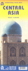

Central Asia Geographical Edition Wall Map
Central Asia Geographical Edition Wall Map at 1:1, 750, 000, size 121 x 81cm / 47.5” x 32” approx. Gizi Map coverage of Central Asia is available either in a geographical version or in a road edition and includes Uzbekistan, Kyrgyzstan, Tajikistan, plus southern Kazakhstan and most of Turkmenistan.Both versions show the region’s rail and road networks, including selected dirt tracks, give driving distances on major roads, and highlight several variants of the Silk Route. All place names are transliterated; local administrative boundaries are marked and names of provinces are shown. Detailed topographic information includes names of mountain ranges, deserts and other geographical features, numerous spot heights and peak names, swamps and salt flats, glaciers, etc. National
parks are marked. Lines of latitude and longitude are drawn at 1° intervals. Index of localities is on the reverse of each map. Map legend includes English.GEOGRAPHICAL EDITION:The map has bold altitude colouring to provide a vivid picture of the region’s topography.Road Edition: Altitude colouring has been replaced by relief shading to provide a clearer background for the road and rail networks. Both versions are available either folded or as a wall map.
parks are marked. Lines of latitude and longitude are drawn at 1° intervals. Index of localities is on the reverse of each map. Map legend includes English.GEOGRAPHICAL EDITION:The map has bold altitude colouring to provide a vivid picture of the region’s topography.Road Edition: Altitude colouring has been replaced by relief shading to provide a clearer background for the road and rail networks. Both versions are available either folded or as a wall map.
Product Description
Reviews/Comments
Add New
Vouchers
No voucher codes found.
Do you know a voucher code for this product or supplier? Add it to Insights for others to use.
Do you know a voucher code for this product or supplier? Add it to Insights for others to use.
 Denmark