
 United Kingdom
 France
 Germany
 Netherlands
 Sweden
 USA
USA
 Italy
Italy
 Spain
Spain
More From Contributor


Austria Freytag & Berndt Panorama Wall Map
Panorama wall map of Austria from the country’s leading cartographic publishers Freytag & Berndt, with coverage including the German Alps and most of Bavaria. Drawn showing the southern slopes of its mountain ranges, the map has Bolzano with the surrounding Dolomites and northern Slovenia at the bottom, looking northwards to Nuremberg and Brno at the top. West/east, the map extends from Lake Constance and the Black Forest beyond Bratislava to Györ in Hungary. Individual mountain ranges, main peaks, rivers and lakes are named, as well as towns including many popular holiday destinations. The map shows the region’s road and rail networks and is surrounded by photos of various locations within Austria.
Product Description
Reviews/Comments
Add New
Intelligent Comparison
Archived Product

Austria: Freytag & Berndt Hiking Maps Stanfords
£9.99
Archived Product

Austria: Freytag & Berndt Cycling Maps Stanfords
£9.99
Archived Product

Austria: Freytag & Berndt 200K Road Maps Stanfords
£10.99
Archived Product
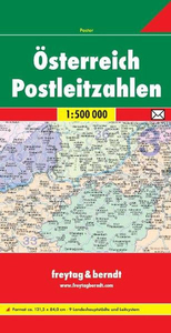
Austria Postcode Freytag & Berndt Map Stanfords
£10.99
Archived Product
World: Freytag & Berndt Political Wall Maps Stanfords
£13.99
Archived Product
Austria Road And Panorama Map Stanfords
£9.95
Vouchers
No voucher codes found.
Do you know a voucher code for this product or supplier? Add it to Insights for others to use.
Do you know a voucher code for this product or supplier? Add it to Insights for others to use.
 Denmark