More From Contributor
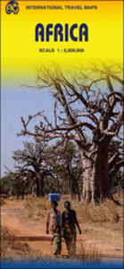
£9.99
Eastern & central Africa at 1:3, 400, 000 on a double-sided indexed map from ITMB with altitude colouring to show its topography & highlighting of numerous national parks & other protected areas. Coverage extends from the northern borders of Kenya & Uganda to southern border of Zimbabwe, & westwards to include parts of the Democratic Republic of Congo, Angola, Namibia & Botswana The map shows the region’s road network with distances marked on main routes & locations of border crossings. Railway lines are included, also international & selected smaller airports. Topography is shown by altitude colouring in broad bands, with relatively few names of mountain ranges, etc, given the map’s scale. Numerous national parks & protected areas are highlighted, shown mostly without their names. Latitude & longitude lines are drawn at 5º intervals. Each side has a separate index. To see other titles in this series please click on the series link. ...
Archived Product
£37.95
This is a guide to the coasts of Kenya, Tanzania, Mozambique, Madagascar & the Comoros for sailors & divers. It


...
Archived Product
£9.99
Equatorial Africa at 1:3, 400, 000 on an indexed, double-sided map from ITMB providing coverage of the whole of Congo (Brazaville), Equatorial Guinea, Democratic Republic of Congo (Kinshasa), Uganda, Rwanda, Burundi, Kenya, Tanzania, Zambia & Angola. Coverage extends from Approx. 6º north of the Equator southwards to the Caprivi Strip in Namibia & the southern tip of Zambia, plus in East Africa to the southern border of Tanzania & Lilongwe in Malawi. Topography is presented by altitude colouring with spot heights & names of main mountain ranges. National parks are highlighted. The map shows the network of roads & selected tracks with border crossings. Regional airports are marked & within the Congo Basin locations accessible by water transport. Symbols indicate various places of interest. The map has latitude & longitude lines at 5º intervals & is indexed. To see other titles in this series please click on the series link. ...
Archived Product
£18.95
An exciting addition to White Star's renowned aerial presentation series, this handsome, compact volume takes readers on a memorable trip over Africa, giving them a rare glimpse of its spectacular, diverse landscapes & wildlife. Photojournalist Paolo Novaresio shares with readers his love of Africa in a portfolio of photographs that transports us to a land that remains, in many ways, wild & untamed. He captured unparalleled pictures of animal herds, savannahs, deserts, & deep jungle by using various means of aerial transport, including a montgolfier, a helicopter, & a twin-engine plane. His unique photographic techniques showcase the topography, light, & color of an entire region at a glance. More than 550 colour photographs reveal a hidden Africa that readers could never experience without the benefit of these stunning aboveground views. Among the regions & countries photographed are Northern Africa & the Sahara Desert, Central Africa, Tanzania, Niger, Congo, Kenya, Ethiopia, Southern Africa, Botswana, Namibia, Zimbabwe, & South Africa. Armchair safari adventurers & world travellers alike will relish this aerial excursion over Africa. This is a welcome addition to this bestselling series. It contains over 550 incredible aerial photographs. ...
Archived Product
£5.59
Africa in the Healthy Travel series from Lonely Planet; comprising a range of handy, pocket-sized guides aimed at minimising health risks for those travelling through high-risk countries & regions. Compiled by a travel health expert, the guide provides practical advice on pre-trip planning (including immunisations), staying healthy while on the road & what to do if you run into problems. The pocket-sized format allows each guide to be used while travelling or alternatively as a useful reference guide from home. Widely recognised for the level of detail included, the Healthy Travel Lonely Planet guides each have the same format, with regional variations to take account of particular local risks. Opening chapters provide detailed advice on pre-trip planning, pre-travel health checks, what to take, books & travel health insurance. Further sections also provide tips on staying healthy on the road & how to get medical help when away. Individual sections are thematically arranged for ease of reference, with individual chapters on Fever & Hepatitis, the Digestive System, Respiratory System, Eyes, Ears & teeth, Skin, HIV/AIDS & Mental Health. Tailored advice is also provided for different groups, including men & women travellers, babies & children & travellers with special needs. There are also dedicated sections to the local climate, altitude, water & bites & stings. A handy ...
Archived Product
£13.95
Jigsaw puzzle from the South African publishers Map Studio presenting Africa on a brightly coloured political map showing the countries with their capital cities, plus a decorative panel with flags of 54 countries. The puzzle, suitable for children from the age of +/- 9 years old, is made from 300 pieces, each 5 x 3cm in size. For parents concerned about having the exactly correct, up-to-date political information: South Sudan is included, the whole of Somalia is shown as one country, Western Sahara is shown as a separate country with El-Aai ...
Archived Product
£16.99
Jigsaw puzzle from the South African publishers Map Studio presenting Africa on a brightly coloured political map showing the countries with their capital cities, plus a decorative panel with flags of 54 countries. The puzzle, suitable for children from the age of +/- 9 years old, is made from 300 pieces, each 5 x 3cm in size. For parents concerned about having the exactly correct, up-to-date political information: South Sudan is included, the whole of Somalia is shown as one country, Western Sahara is shown as a separate country with El-Aaiún as its capital but its flag is not included in the decorative panel. ...
Archived Product
£12.99
Adele is in a mess. On her own with her young son, struggling to cope with her job as a teacher, & stuck in a disastrous
- &
...
Archived Product
£28.99
Large 101 x 121cm encapsulated political map of Africa from Maps International, at a scale of 1:8, 000, 000 with insets of Cape Verde, Azores, Seychelles & Mauritius. Countries are shown in vivid colours against light blue oceans. Country names are in large, clearly legible print. English versions for capitals & most city names are used, with population information displayed on the legend; international, state & disputed boundaries are displayed. Major & minor railways are indicated where possible, with some major roads also shown The map has well designed relief shading to show mountainous areas enhancing the overall presentation; the colouring of the oceans shows different depths. Projection is Miller Oblated. The map also contains a panel of country flags in the corner.*LAMINATED & ENCAPSULATED WALL MAPS:*- *laminated* wall maps have a thin layer of plastic usually applied to the printed side only. They can be written on with suitable marker pens without any damage to the map but, unless laminated on both sides, they are not damp-proof.- *encapsulated* wall maps are sealed between two sheets of plastic. They are more rigid & heavier than laminated maps of the same size. They are damp-proof & do not crinkle in humid conditions. Encapsulation gives the map a shiny surface, similar to being displayed behind glass.- *please note:* many publishers & retailers often use these two terms interchangeably. Our map titles & descriptions follow the definitions provided above. ...
Archived Product
£19.99
Large 101 x 121cm paper political map of Africa from Maps International, at a scale of 1:8, 000, 000 with insets of Cape Verde, Azores, Seychelles & Mauritius. Countries are shown in vivid colours against light blue oceans. Country names are in large, clearly legible print. English versions for capitals & most city names are used, with population information displayed on the legend; international, state & disputed boundaries are displayed. Major & minor railways are indicated where possible, with some major roads also shown The map has well designed relief shading to show mountainous areas enhancing the overall presentation; the colouring of the oceans shows different depths. Projection is Miller Oblated. The map also contains a panel of country flags in the corner. ...
Archived Product

Africa ITMB

Africa on a large, indexed map at 1:5, 000, 000 from ITMB with country names and boundaries clearly marked on a base with physical colouring. The map is double-sided, with the division of the continent arranged so that all the countries are shown complete on either one side of the map or the other. Cape Verde Islands and Madagascar are included.The base map has elevation colouring, although there is no indication in the map legend of the altitude bands and no spot heights are marked on the map. The number of various topographic features named on the map (mountain ranges, rivers, etc) varies considerably from region to region. Numerous national parks and other protected areas are highlighted, mostly not named. Town symbols indicate the size of the populations. The map shows the
network of road and rail connections and highlights various places of interest, including selected UNESCO World Heritage sites. As with the physical detail, the amount of information shown on the map varies considerably from country to country. Latitude and longitude lines are drawn at 10° intervals. Each side has a separate index.The map also includes street plans of central Alexandria and Khartoum and an enlargement showing the environs of Cairo.
RIP - This product is no longer available on our network. It was last seen on 25.09.2019

This page now acts as a permanent archive for this product. Add more information using the comments box below to ensure it can still be found by future generations.

Use our search facility to see if it is available from an alternative contributor.
  • External links may include paid for promotion
  • Availability: Out Of Stock
  • Supplier: Stanfords
  • SKU: 9781553415206
Availability: In Stock
£9.99

Product Description

Africa on a large, indexed map at 1:5, 000, 000 from ITMB with country names & boundaries clearly marked on a base with physical colouring. The map is double-sided, with the division of the continent arranged so that all the countries are shown complete on either one side of the map or the other. Cape Verde Islands & Madagascar are included. The base map has elevation colouring, although there is no indication in the map legend of the altitude bands & no spot heights are marked on the map. The number of various topographic features named on the map (mountain ranges, rivers, etc) varies considerably from region to region. Numerous national parks & other protected areas are highlighted, mostly not named. Town symbols indicate the size of the populations. The map shows the network of road & rail connections & highlights various places of interest, including selected UNESCO World Heritage sites. As with the physical detail, the amount of information shown on the map varies considerably from country to country. Latitude & longitude lines are drawn at 10° intervals. Each side has a separate index. The map also

Includes::
street plans of central Alexandria & Khartoum & an enlargement showing the environs of Cairo.

Reviews/Comments

Add New

Intelligent Comparison

Oooops!
We couldn't find anything!
Perhaps this product's unique.... Or perhaps we are still looking for comparisons!
Click to bump this page and we'll hurry up.

Price History

Vouchers

No voucher codes found.
Do you know a voucher code for this product or supplier? Add it to Insights for others to use.

Facebook

Jargon Buster

Madagascar - An Island nation in the Indian Ocean
Physical - Used to describe strength or visual properties of an item
World - A physical grouping, commonly used to describe earth and everything associated with ti
Size - is the measurement of how big an object is in space.
Network - A link and communication between things. Often computers or people.
Large - something that takes up more space than normal.
Road - a manmade lane or a path that is used to speed up travel.
Altitude - Something that can be quite high in relation to sea or ground level.

Supplier Information

Stanfords
Stanfords was established in 1853 and opened their iconic Covent Garden flagship store in 1901. They have become the top retailer of maps, travel books and accessories in the UK and arguably offer the largest selection of maps and travel books worldwide. Famous names such as Captain Robert Falcon Scott, Ranulph Fiennes and Michael Palin have purchased from Stanfords. They now have a shop in Bristol and both stores together with other venues operate a calendar of events including talks, book signings and exhibitions. As a specialist map retailer, the map selection is comprehensive and includes road maps, street maps and walking maps from worldwide destinations, as well as a selection of world atlases and wall maps. Books include travel guides and travel literature. Stanfords also stock globes, from miniatures made of blue marble to magnificent floor-standing globes. The website features a selection of interesting articles on travel topics.
Page Updated: 2023-11-12 20:15:36

Community Generated Product Tags

Oh No! The productWIKI community hasn't generated any tags for this product yet!
Menu