
 United Kingdom
 France
 Germany
 Netherlands
 Sweden
 USA
USA
 Italy
Italy
 Spain
Spain
More From Contributor


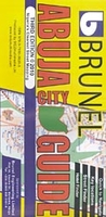
Abuja
Abuja at 1:20, 000 on a clear, well presented, indexed street plan from MDZ Multimedia, with on the reverse a street plan of Kubwa and a road map of Nigeria’s Federal Capital Territory (FCT). On one side is the street plan of the capital. Within the city centre and is most other districts not only the main but also most of the smaller streets are named. A wide range of symbols indicate government offices, embassies, various public buildings, police stations, hospitals and clinics, schools, shopping centres and markets, post offices and internet cafes, etc., as well as hotels and guest houses, restaurants, car hire facilities and petrol stations. The index on the reverse lists streets, plus the various places marked on the map. Also provided is a separate hotel finder with
full contact details.The reverse side also includes a street plan of Kubwa at 1:20, 000, a basic road map of the Abuja – Kubwa area, a large map of the Federal Capital Territory showing its administrative division into counties with the road network, plus a small map of Nigeria with the division into states.
full contact details.The reverse side also includes a street plan of Kubwa at 1:20, 000, a basic road map of the Abuja – Kubwa area, a large map of the Federal Capital Territory showing its administrative division into counties with the road network, plus a small map of Nigeria with the division into states.

Product Description
Reviews/Comments
Add New
Vouchers
No voucher codes found.
Do you know a voucher code for this product or supplier? Add it to Insights for others to use.
Do you know a voucher code for this product or supplier? Add it to Insights for others to use.
 Denmark