More From Contributor
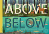
£6.99
This is a new pocket guide book aimed at cultural & heritage tourists. It explores festivals, events, castles, museums, galleries, historic houses & industrial heritage throughout South East Wales. The book is heavily illustrated with superb pictures throughout the content. The About Wales pocket guides have over 100 ideas each on what to see & do in that region of Wales, with information about where to stay & eat. It

Includes::
a foreword by Sian Lloyd & writer David Williams.

...
Archived Product
£7.99
Once, when asked for advice on how to become a writer, Lopez found himself replying: Read. Find out what you truly believe. Get away from the familiar. This collection of essays stems directly from that philosophy. Here is far-flung travel (the beauty of remote Hokkaido Isl&, the over-explored Galapagos, enigmatic Bonaire); a naturalist's concerns (for endangered communities as well as their land) & pure adventure. Here, too, are seven exquisite memory pieces; beautiful, meditative recollections that will stand as classic examples of the personal essay. ...
Archived Product
£1.99
From Stonehenge to beyond the Big Bang, an exhilarating scientific exploration of how we make time Time is the grandest conception of the universe that we humans have been able to imagine – & its most intimate, the very frame of human life. In About Time, astrophysicist & award-winning writer Adam Frank tells the scientific story of this wonderful & tyrannical invention.A Palaeolithic farmer moved through the sun-fuelled day & star-steered night in a radically different way than the Elizabethan merchants who set their pace to the clocks newly installed in their town squares. Since then, science has swept time into increasingly minute & standardized units – the industrial efficiency of ironworks’ punch clocks; the space-age precision of atomic fountains & GPS satellites; the fifteen-minute increments of Outlook’s digital revolution. & in the past decade, string-theory branes, multiverses, & “clockless” physics have begun to overturn our ideas about how the universe began – the Big Bang – in ways that will completely rewrite time & our experience of it. Weaving cosmology with day-to-day chronicles & a down-to-earth style, About Time is both dazzling & riveting as it confronts what comes next. ...
Archived Product
£12.99
Above All Things is a heart-wrenchingly romantic historical novel by Tanis Rideout, based on British mountaineer George Mallory's fatal attempt to climb Everest, & his wife Ruth, who is left at home, waiting for him to return to her. In the Himalayas two climbers strike out for the summit of the Earth's highest mountain
- aiming to be the first to the top, & reclaim a little of Britain's lost glory. In Cambridge, a wife collects the milk, gets three children out of bed & waits for a letter, a telegram
- for news of her husb&. It is 1924 & after months of setbacks & failures, George Mallory & Andrew Sandy Irvine are attempting to be the first to conquer Everest. Alone on the mountain they struggle against inhuman cold, violent winds, thin air
- but climbing, putting one foot falteringly after another, they reach for the cloud-shrouded peak. At home Ruth Mallory goes about her day; visiting friends & comforting children she longs for news of George. She considers her marriage
- the passion, the fights, the bitter absences, the loving reunions, all the snatched moments during the war & between expeditions. She hides her doubts & the uncertainty about the future with or
- god forbid
- without him. A powerful, moving story of a husband driven to extraordinary lengths by his ambition & a wife terrified she will lose him to a cruel & pitiless rival, Above All Things is a timeless story of one of the great tragedies
- & love stories
- of the last century. Above All Things has it all: adventure, tragedy, mystery, & a deeply moving love story. It's gorgeously written & beautifully paced. I could not put it down. Prepare to be dazzled. (Alison Pick, author of Far to Go). A love story, a tale of adventure, & a study in obsession all at once, Above All Things is simply breathtaking. With Tanis Rideout's debut, a major new voice in Canadian fiction arrives. (Joseph Boyden, author of Through Black Spruce). Timeless romance, an unflinching love story that touches the very core of the human condition. Rideout leaves readers holding the book close to their chest, knowing that the purpose of life, above all else, is love. (Telegraph). A must-read for Everest buffs with a sensitive side, & for those who want to understand the anatomy of climbing accidents. It is also the perfect summer read for anyone lured by the romance of adventure, as the story goes well beyond the vast summit of Everest into much trickier terrain: the unmapped topography of the heart. (Globe & Mail). Tanis Rideout's work has appeared in numerous publications & been shortlisted for several prizes, including the Bronwen Wallace Memorial Award for Emerging Writers & the CBC Literary Award. In 2006, she was named the Poet Laureate for Lake Ontario by the environmental advocacy group Lake Ontario Waterkeeper & joined Gord Downie of The Tragically Hip on a tour to promote environmental justice on the lake. Born in Belgium, Tanis grew up in Bermuda & in Kingston, Ontario, & now lives in Toronto. She recently received her MFA from the University of Guelph-Humber. Above All Things is her first novel.


...
Archived Product
£11.99
Lift the lid on eight animal habitats to see the extraordinary natural stories that happen above & below the surface. From the rainforest to the ocean & the macro to the micro, lift the flap to explore the fascinating relationships occurring in each of the world`s ecosystems. ...
Archived Product
£25.00
The past two centuries have marked the age of the city in Scotl&. Powered by industrial growth & driven by social change, much of the nation has been transformed from the rural to the urban. But the stories of our cities began long before this. From ancient origins to the construction of some of the world`s most fascinating buildings, through hardships of war, plague, fire & economic depression to innovative programmes of urban renewal, our cities bear the scars & boast the treasures of thousands of years of incredible progress & change. Across the central belt, vast, brash Glasgow meets classically austere Edinburgh. Dundee, a city built by an old Empire, now thrives on new technology. In the granite shadows of Aberdeen, a vibrant fishing community has been changed forever by the arrival of the oil barons. & then there are Scotland`s newest cities: Stirling, once a centre of Royal power, & Inverness, the urban gateway to a wild Highland landscape. This lavishly illustrated volume looks at the character & development of each of Scotland`s six cities, drawing on stunning aerial photography from the 1920s to the present day to tell their fascinating stories from a unique & illuminating perspective. & for the first time ever, in a special dedicated section, readers can view images of Scotland`s cities in 3D, seeing stunning details rise up out of the page, from the imposing rocky heights of the castles of Edinburgh & Stirling, to the ordered grid-iron canyons of central Glasgow. ...
Archived Product
£25.00
The landscape of Scotland is full of dramatic contrasts. The high, rugged peaks of the Cairngorms look down on the rounded hills of the southern uplands. Wild moorlands run into fertile flood-plains. The coastline ranges from soft sandy beaches & crystal-clear waters to jagged cliffs battered by the fierce waves of the Atlantic. Aerial photography provides unique & striking perspectives on how the people of Scotland have lived, worked, fought over, worshipped, developed & changed this l&, leaving no part untouched or unaltered by human activity. The Royal Commission on the Ancient & Historical Monuments of Scotland (RCAHMS) holds the national collection of aerial photography for Scotland with millions of images dating from the 1920s to the present day. These photographs
- many of which have never been seen before by the public
- tell the remarkable story of a changing nation, from stone circles, Roman remains & ruined castles, to the growth of villages, towns & cities, the rise & fall of heavy industry, the country at war & the proud engineering & architecture of the modern landscape. For the first time in one volume, RCAHMS has brought together the finest images from its collection in a stunning illustration of Scotland's past, present & future.

...
Archived Product
£6.39
A detailed topographic map of Aboyne, Alford & Strathdon from the Ordnance Survey Explorer series, showing part of Cairngorms National Park Edition A1 with minor changes; Publication date April 2010 About this series: These highly detailed maps show all the administrative boundaries, settlements as small as isolated farms, the road network down to unfenced roads & country tracks, & field boundaries (hedges & drystone walls) which make navigation across the countryside much easier. Steep gradients on roads are indicated. Various landmarks, e.g. powerlines, archaeological sites, windmills, churches & lighthouses are shown & additional graphics indicate natural terrain features such as cliffs, scree, mud & vegetation variations. The contour interval is 5 metres in the lower parts of the country & 10 metres in the uplands, & spot heights are marked. Each map covers an area of 30 x 20km (i.e. approx. 19 x 12 miles), with some double-sided maps covering more, as indicated in the individual descriptions. The maps are fully GPS compatible, with the National Grid shown at 1km intervals & latitude & longitude indicated by margin ticks at 1'. The Explorer series has replaced the earlier, green-cover Pathfinder maps. The Explorer series is now complete & covers all of Engl&, Wales & Scotl&. Some sheets for popular areas like the National Parks are still branded as Outdoor Leisure (OL) maps, but are now included in this series as the cartography is the same as that in the Explorer Maps. The Explorer maps offer a substantial improvement on the Pathfinder series, with greater use of colour, larger area per map, & stronger emphasis on information for ramblers & tourists. This series is ideal for walking & other outdoor pursuits & each map shows a large amount of information for ramblers & tourists. Public rights of way are shown (except in Scotland), together with other routes with public access: National Trails & Recreational Paths, permitted paths & bridleways, & selected cycle routes. Open access land created under the Countryside & Rights of Way Act 2000 is marked. Tourist information

Includes::
caravan & camp sites, Park & Ride locations, recreation/leisure/sport centres, museums, historic buildings, English Heritage & National Trust sites, rural pubs, etc. The map legend is in English only, except for the tourist information content which is also in French & German.

...
Archived Product
£11.19
Laminated waterproof edition of a detailed topographic map of Aboyne, Alford & Strathdon from the Ordnance Survey Explorer series, showing part of Cairngorms National Park Edition A1 with minor changes; Publication date: April 2010 About this series: These highly detailed maps show all the administrative boundaries, settlements as small as isolated farms, the road network down to unfenced roads & country tracks, & field boundaries (hedges & drystone walls) which make navigation across the countryside much easier. Steep gradients on roads are indicated. Various landmarks, e.g. powerlines, archaeological sites, windmills, churches & lighthouses are shown & additional graphics indicate natural terrain features such as cliffs, scree, mud & vegetation variations. The contour interval is 5 metres in the lower parts of the country & 10 metres in the uplands, & spot heights are marked. Each map covers an area of 30 x 20km (i.e. approx. 19 x 12 miles), with some double-sided maps covering more, as indicated in the individual descriptions. The maps are fully GPS compatible, with the National Grid shown at 1km intervals & latitude & longitude indicated by margin ticks at 1'. The Explorer series has replaced the earlier, green-cover Pathfinder maps. The Explorer series is now complete & covers all of Engl&, Wales & Scotl&. Some sheets for popular areas like the National Parks are still branded as Outdoor Leisure (OL) maps, but are now included in this series as the cartography is the same as that in the Explorer Maps. The Explorer maps offer a substantial improvement on the Pathfinder series, with greater use of colour, larger area per map, & stronger emphasis on information for ramblers & tourists. This series is ideal for walking & other outdoor pursuits & each map shows a large amount of information for ramblers & tourists. Public rights of way are shown (except in Scotland), together with other routes with public access: National Trails & Recreational Paths, permitted paths & bridleways, & selected cycle routes. Open access land created under the Countryside & Rights of Way Act 2000 is marked. Tourist information

Includes::
caravan & camp sites, Park & Ride locations, recreation/leisure/sport centres, museums, historic buildings, English Heritage & National Trust sites, rural pubs, etc. The map legend is in English only, except for the tourist information content which is also in French & German.

...
Archived Product
£14.99
Aboyne, Alford & Strathdon area of the Scottish Highlands on a detailed topographic & GPS compatible map OL59, waterproof version, from the Ordnance Survey’s 1:25, 000 Explorer series. Coverage

Includes::
part of the Cairngorms National Park, Ballater, Lochs Davan & Kinord, etc.MOBILE DOWNLOADS: this title & all the other OS Explorer maps include a code for downloading after purchase the digital version onto your smartphone or tablet for viewing on the OS smartphone app.OS EXPLORER SERIES: to see the list of all the titles in the OS Explorer series, both paper & waterproof versions, please click on the series link. The Explorer series, Ordnance Survey’s most detailed maps recommended for anyone enjoying outdoor activities, provides topographic coverage of Great Britain at 1:25, 000 on GPS compatible maps with hiking trails, cycling routes & extensive tourist information. Each printed map is available either on paper or as a waterproof & tear-resistant OS Active Map, as indicated in its title. Britain’s National Parks & other areas of particular tourist interest are presented on often double-sided OL (Outdoor Leisure) maps, whilst most standard format Explorers cover an area of 30 x 20km (approx. 19 x 12 miles). All three versions (paper, waterproof & digital) are the same & provide plenty of recreational & tourist information, indicating the traditional public right of way paths (except in Scotland where different laws apply), including bridleways & byways. National Trails & other long-distance paths are marked, as well as permissive footpaths or bridleways & on-road or traffic-free cycle routes with, where appropriate, their National/ Regional Cycle Network numbers. Boundaries of access land are clearly marked. A wide range of symbols provides additional tourist information, highlighting camping & caravanning sites, information offices & visitors’ centres, parking & picnicking places, country pubs, sport & recreational facilities including cycle hire locations & mountain biking trails, historic buildings & museums, etc. Exceptionally clear presentation of the landscape is provided by contours at 5m or in the uplands at 10m intervals, with additional spot heights plus colouring and/or graphics for different types of woodlands, orchards, heath, marshl&, scree or boulders, & other topographic features. For GPS users the maps have British National Grid lines at 1km intervals, with latitude & longitude given by margin ticks at 1`. Clearly laid out map legend

Includes::
French & German translations for the tourist information symbols.


...
Archived Product

Above And Below

Lift the lid on eight animal habitats to see the extraordinary natural stories that happen above and below the surface. From the rainforest to the ocean and the macro to the micro, lift the flap to explore the fascinating relationships occurring in each of the world`s ecosystems.
RIP - This product is no longer available on our network. It was last seen on 25.09.2019

This page now acts as a permanent archive for this product. Add more information using the comments box below to ensure it can still be found by future generations.

Use our search facility to see if it is available from an alternative contributor.
  • External links may include paid for promotion
  • Availability: Out Of Stock
  • Supplier: Stanfords
  • SKU: 9781848576070
Availability: In Stock
£7.99

Product Description

Lift the lid on eight animal habitats to see the extraordinary natural stories that happen above & below the surface. From the rainforest to the ocean & the macro to the micro, lift the flap to explore the fascinating relationships occurring in each of the world`s ecosystems.

Reviews/Comments

Add New

Intelligent Comparison

Oooops!
We couldn't find anything!
Perhaps this product's unique.... Or perhaps we are still looking for comparisons!
Click to bump this page and we'll hurry up.

Price History

Vouchers

No voucher codes found.
Do you know a voucher code for this product or supplier? Add it to Insights for others to use.

Facebook

Jargon Buster

World - A physical grouping, commonly used to describe earth and everything associated with ti
Natural - not manmade

Supplier Information

Stanfords
Stanfords was established in 1853 and opened their iconic Covent Garden flagship store in 1901. They have become the top retailer of maps, travel books and accessories in the UK and arguably offer the largest selection of maps and travel books worldwide. Famous names such as Captain Robert Falcon Scott, Ranulph Fiennes and Michael Palin have purchased from Stanfords. They now have a shop in Bristol and both stores together with other venues operate a calendar of events including talks, book signings and exhibitions. As a specialist map retailer, the map selection is comprehensive and includes road maps, street maps and walking maps from worldwide destinations, as well as a selection of world atlases and wall maps. Books include travel guides and travel literature. Stanfords also stock globes, from miniatures made of blue marble to magnificent floor-standing globes. The website features a selection of interesting articles on travel topics.
Page Updated: 2023-11-12 20:15:36

Community Generated Product Tags

Oh No! The productWIKI community hasn't generated any tags for this product yet!
Menu