
 United Kingdom
 France
 Germany
 Netherlands
 Sweden
 USA
USA
 Italy
Italy
 Spain
Spain
More From Contributor


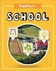


Mapping A Country
OK: you live in a country. (Probably Britain.) You know its name and lots of stuff about it. But would you know where to find it on a map? Or what it looks like? Or what key features it has? This book lets you learn more about the UK while finding out what maps can tell you about it. Even better, it’s full of hands-on activities that let you practise your skills. You’ll find out what a birds-eye map is, look at amazing aerial photos, and see how landmarks can be shown as symbols. You’ll also learn how to explore your local countryside with a compass and various types of maps. Essential skills for map reading and map making Fun activities linked to various mapping topics Explores grids, scale, compass points, map keys and contour lines Includes land use maps, road maps,
pathway maps and more britain
pathway maps and more britain


Product Description
Reviews/Comments
Add New
Vouchers
No voucher codes found.
Do you know a voucher code for this product or supplier? Add it to Insights for others to use.
Do you know a voucher code for this product or supplier? Add it to Insights for others to use.
 Denmark