These attractive & cleverly structured guides will give walkers ten of the best themed short circular walks in Britain's 14 National Parks. With clear information, an overview & introduction for each walk, expertly written numbered directions, large scale Ordnance Survey maps, superb eye-grabbing panoramic photographs, & interpretation of points of interest along the way, these guides set a new standard in clarity & ease-of-use. Featured walks in the Snowdonia National Park include: Aberfalls, Llyn Crafnant & Llyn Geirionydd, Roman Steps, Llyn Padarn & Llanberis, Tal y Fan & Conwy Mountain, Capel Curig, Harlech, Cadair Idris, Snowdon, Llyn Cwellyn & Mynydd Mawr. ...
The 80 mile/125km long North Wales Coast section of the Wales Coast Path between Chester & Bangor runs alongside the broad Dee Estuary & traditional seaside towns past Conwy Castle, the Great Orme, Penmaenmawr & Conwy Mountain to the university town of Bangor on the Menai Strait. This Official Guide splits the route into 8 convenient day sections, each of about 9-12 miles / 14-20 kilometres. It contains everything local & long-distance walkers need to enjoy the path. ...
This revised version of the Pathfinder walking guidebook for Northumberland & the Scottish Borders contains 28 carefully selected walking routes to help you make the most of the area. All the routes have been created & tested by seasoned walkers, & range from two to thirteen miles in length. Each route Includes:: a detailed route description, & extract of the OS map for the area & notes on key features & historical information to help you make the most of your walk. The area Includes:: medieval castles such as Dunstanburgh & Hermitage, as well as Hadrian's Wall. You can also see the ruins of Kelso Abbey, visit Kielder Forest Park or explore the tranquil beauty of the Holy Island of Lindisfarne This book is one of a series that covers the best walking areas in Britain, giving details to help you find the best walking routes & places to visit. ...
The National Parks Scratch Map. All 15 National Parks, plus an extra 30 squares to scratch off, & 60 free to visit places labelled to help you plan your adventures! There’s top ten lists of the best activities to try, wildlife to spot & mountains to climb to help you make the most of your travels. ...
Northumberland is England's most northern county, a magical place filled with ancient castles, golden sand beaches, rolling hills, rugged moorland & friendly little Northumberland towns & villages. This much-awaited addition to the award-nominated series of easy walking guides is an affordable & practical guide to 40 of the best family walks in the region. ...
Bigger, better & stronger… what more could you want in a flask? The inner lining has been expanded to become more durable & dishwasher safe with an enhanced stopper making it leak-proof so you need not have any fears on spillages in your rucksack. ...
This attractive & cleverly structured guide gives walkers ten of the finest short, circular, themed walks in the Peak District National Park in a popular pocketable format. With clear information, an overview & introduction for each walk, expertly written numbered directions, large scale Ordnance Survey maps, superb eye-grabbing panoramic photographs, & interpretation of points of interest along the way, these guides set a new standard in clarity & ease-of-use. Featured walks include: Peacock Inn, Bakewell - pub walk, Dovedale - dales & valleys, Castleton & Cave Dale - dales & valleys, Chatsworth - history walk, Stanage Edge - rocks & edges, Lud's Church - history walk, Three Shires Head - waterside walk, The Roaches - rocks & edges, Shutlingsloe - moors & tors, Edge of Kinder - moors & tors. About the author Dennis Kelsall is a professional writer of UK outdoor guides & has authored several guides to the Peak District National Park. He is also a member of the Outdoor Writers & Photographers Guild. ...
Available
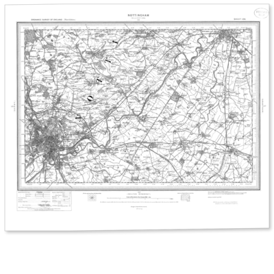
Nottingham 1896-1904
Reproduction map of Nottingham from the Revised New Edition, 1896 to 1904. Available flat (rolled) or framed.
Navigate your world with confidence with Ordnance Survey (https://shop.ordnancesurvey.co.uk/)! Explore our extensive range of maps, guides, and outdoor gear designed to help you explore the great outdoors with ease. From detailed maps for hiking and cycling to innovative GPS devices, we've got everything you need to plan your next adventure. With our heritage of accuracy and reliability, Ordnance Survey is your trusted companion for exploring the UK's landscapes, whether you're a seasoned explorer or a weekend wanderer. Gear up and discover new horizons with Ordnance Survey today!
Page Updated: 2024-03-04 13:47:34
Community Generated Product Tags
Oh No! The productWIKI community hasn't generated any tags for this product yet!