
 United Kingdom
 France
 Germany
 Netherlands
 Sweden
 USA
USA
 Italy
Italy
 Spain
Spain
More From Contributor


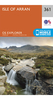


Ordnance Survey Isle Of Arran - Landranger 69 Map
Perfect for day trips and short breaks, the OS Landranger Map series covers Great Britain with 204 detailed maps. each map provides all the information you need to get to know your local area at 1:50 000 scale. Visitors and residents alike will appreciate

Product Description
Perfect for day trips & short breaks, the OS Landranger Map series covers Great Britain with 204 detailed maps. each map provides all the information you need to get to know your local area at 1:50 000 scale. Visitors & residents alike will appreciate the level of detail, which
Includes:: places of interest, tourist information, picnic areas & camping sites, plus Rights of Way information for england & Wales.
Reviews/Comments
Add New
Intelligent Comparison
Archived Product

Ordnance Survey Anglesey - Landranger 114 Map Ellis Brigham
£8.99
Archived Product
Ordnance Survey Gloucester & Forest Of Dean - Landranger 162 Map Ellis Brigham
£8.99
Archived Product

Ordnance Survey Rum, Eigg & Muck - Landranger 39 Map Ellis Brigham
£8.99
Archived Product

Ordnance Survey Glen Garry & Loch Rannoch - Landranger 42 Map Ellis Brigham
£8.99
Archived Product
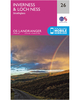
Ordnance Survey Glen Carron & Glen Affric - Landranger 25 Map Ellis Brigham
£8.99
Archived Product

Ordnance Survey Glasgow, Motherwell & Airdrie - Landranger 64 Map Ellis Brigham
£8.99
Archived Product

Ordnance Survey Ballater, Glen Clova - Landranger 44 Map Ellis Brigham
£8.99
Archived Product

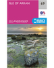
Ordnance Survey Oban & East Mull - Landranger 49 Map Ellis Brigham
£8.99
Vouchers
No voucher codes found.
Do you know a voucher code for this product or supplier? Add it to Insights for others to use.
Do you know a voucher code for this product or supplier? Add it to Insights for others to use.
 Denmark