More From Contributor

£56.99
Garmin GB Discoverer The Peak District Map Preprogrammed Datacard Description: Navigate with Ordnance Survey mapping on your Garmin GPS. Available in 1:25K scale maps with detailed topographic data including terrain contours, topo elevations, summits, paths, routable roads & geographical points. Turn-by-turn navigation anywhere in Great Britain is made possible with integrated street maps, included on all Garmin GB Discoverer products. Search, select & navigate to street addresses & attractions & follow routes on foot, in car or by bike using the familiar Ordnance Survey backdrop. ...
Archived Product
£53.94
Garmin GB Discoverer The Yorkshire Dales Map Preprogrammed Datacard Description: Navigate with Ordnance Survey mapping on your Garmin GPS. Available in 1:25K scale maps with detailed topographic data including terrain contours, topo elevations, summits, paths, routable roads & geographical points. Turn-by-turn navigation anywhere in Great Britain is made possible with integrated street maps, included on all Garmin GB Discoverer products. Search, select & navigate to street addresses & attractions & follow routes on foot, in car or by bike using the familiar Ordnance Survey backdrop. ...
Archived Product
£319.99
Garmin GPS MAP 64st Topo Europe Rugged, Full-featured Handheld with GPS, GLONASS, Advanced Sensors & Wireless Connectivity *2, 6" sunlight-readable colour screen * High-sensitivity GPS & GLONASS receiver with quad-helix antenna * Barometric altimeter & 3-axis compass * Preloaded Recreational map of Europe * Wireless connectivity via Bluetooth technology&sup 1 or ANT+ The new GPSMAP 64st handheld navigator features a 2, 6" sunlight-readable screen & a high-sensitivity GPS & GLONASS receiver with a quad helix antenna for superior reception. The rugged & waterproof GPSMAP 64st comes with barometric altimeter, 3-axis compass & a preloaded Recreational Map of Europe. It wirelessly connects to your smartphone to allow Live Tracking & Smart Notification.&sup 2 Physical & Performance Physical dimensions 2.4" x 6.3" x 1.4" (6.1 x 16.0 x 3.6 cm) Display size, Wx H 1.43" x 2.15" (3.6 x 5.5 cm) 2.6" diag (6.6 cm) Display resolution, Wx H 160 x 240 pixels Display type transflective, 65-K color TFT Weight 8.1 oz (230 g) with batteries Battery 2 AA batteries (not included) Ni MH or Lithium recommended Battery life 16 hours Water Rating IPX7 ...
Archived Product
£219.99
Garmin GPSMAP 64 with TOPO UK & Ireland Light This recreational map has been compiled using the community generated Open Street Map (OSM) database to which Garmin added a 50-metre contour line layer, based on a public digital elevation model, & over 20 years of knowledge & skills in building electronic maps. The resulting map can be used for orienteering & reference for any outdoor or recreational activities throughout UK & Irel&. These new maps include routable road, trail & path networks, waterway detail, place names, military areas, natural features, land use areas, historical sites, airport structures & points, buildings, emergency structures, power lines, railways & many points of interests (POI) including but not limited to tourism, sport, shops, public transport, leisure, craft & amenities. TOPO UK & Ireland Light is capable of turn-by-turn routing on the entire road & trail network present in the map. The routing allows the creation of routes based on your selected activity type 1by automatically adjusting the route to suit the chosen activity & take into consideration the elevation. It is not recommended to use this map for car navigation purposes. Features Provides turn-by-turn visual navigation with alert tones on the entire road & trail network, including unpaved roads & footpaths. * Garmin optimised routing 1calculates routes based on activity
- Pedestrian, Hiking, Mountaineering, Tour Cycling, Cycling & Mountain Biking. * Displays named hiking & bike trails 1. * Shows land coverage, including forests, farml&, rivers, lakes, wetlands & urban areas. *
Includes: contour lines & Digital Elevation Model (DEM). * Detailed digital elevation model enables the display of accurate altitude profiles. * Searchable map elements such as points of Interests, mountains & lakes 2 * Plan routes using this map in Base Camp.

...
Archived Product
£269.99
Garmin GPSMAP 64s with TOPO UK & Ireland Light Rugged, Full-featured Handheld with GPS, GLONASS, Advanced Sensor & Wireless Connectivity *2, 6" sunlight-readable colour screen * High-sensitivity GPS & GLONASS receiver with quad helix antenna *1-year Birds Eye Satellite Imagery subscription * Also

Includes::
Worlwide basemap with shaded relief * Barometric altimeter & 3-axis compass * Outdoor optimised dual battery system * Wireless connectivity via Bluetooth technology&sup 1 or ANT+ The new GPSMAP 64s handheld navigator features a 2.6" sunlight-readable screen & a high-sensitivity GPS & GLONASS receiver with a quad helix antenna for superior reception. The rugged & waterproof GPSMAP 64s comes with a barometric altimeter & a 3-axis compass. It wirelessly connects to your smartphone to allow Live Tracking & Smart Notification.&sup 2 Physical & Performance Physical dimensions 6.1 x 16.0 x 3.6 cm Display size, Wx H 3.6 x 5.5 cm 6.6 cm diagonal Display resolution, Wx H 160 x 240 pixels Display type Transflective, 65-K color TFT Weight 260.1g with batteries Battery 2 AA batteries (not included) Ni MH or Lithium recommended Battery life 16 hours Water Rating IPX7

...
Archived Product
£56.80
Garmin Montana Auto Suction Cup Mount Take advantage of Montana TM's versatility. Place your Montana in your car dashboard or windshield with this automotive suction cup mount&sup 1 & take it on the road. This kit

Includes::
a mount with an integrated speaker & a suction cup for simple installation. It also

Includes::
a vehicle power cable.


...
Archived Product
£56.99
Garmin National Trails the Coast to Coast Map Preprogrammed Datacard Description: Navigate with Ordnance Survey mapping on your Garmin GPS. Available in 1:25K scale maps with detailed topographic data including terrain contours, topo elevations, summits, paths, routable roads & geographical points. Turn-by-turn navigation anywhere in Great Britain is made possible with integrated street maps, included on all Garmin GB Discoverer products. Search, select & navigate to street addresses & attractions & follow routes on foot, in car or by bike using the familiar Ordnance Survey backdrop. ...
Archived Product
£124.88
Garmin New Mapping 1.50K Central (Northern England & Midlands) Explore Northern England & the Midlands with detailed 50K topographic & road maps. Garmin GB Discoverer 1:50K
- Northern England & Midlands contains full 1:50K scale Ordnance Survey Landranger map coverage for the entire region. Plus, with NAVTEQ road data & points of interest, you'll get turn-by-turn directions to your destination.GB Discoverer's detailed topographic data

Includes::
terrain contours, topo elevations, summits, paths, routable roads & geographical points. The premium NAVTEQ road data is the same detailed data included in our leading automotive products
- with thousands of addresses & points of interest, including lodging, food & drink, car parks, banks, petrol stations, attractions, campsites, & more. Search for an address or point of interest, & your Garmin device displays turn-by-turn directions to your destination. Topographic coverage of Northern England & the Midlands.

Includes::
northern England from Northumberland National Park & Kielder Forest Park to Lowestoft, the Norfolk Broads & the northern part of Wales, including Snowdonia National Park.


...
Archived Product

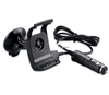
Garmin Handlebar Mounting Bracket (Garmin Handlebar Mounting Bracket)

Garmin Handlebar Mounting Bracket Your device snaps securely into this handlebar mount, which fits up to a 1" (2.54 cm) diameter bar. Includes mounting hardware and instructions. Fits GPS 60, GPSMAP 60, GPSMAP 60C, GPSMAP 60CS, GPSMAP 60CSx, GPSMAP 60Cx.
RIP - This product is no longer available on our network. It was last seen on 26.10.2016

This page now acts as a permanent archive for this product. Add more information using the comments box below to ensure it can still be found by future generations.

Use our search facility to see if it is available from an alternative contributor.
  • Availability: Out Of Stock
  • Supplier: All Outdoor
  • SKU: 10741
Availability: In Stock
£14.55

Product Description

Garmin Handlebar Mounting Bracket Your device snaps securely into this handlebar mount, which fits up to a 1" (2.54 cm) diameter bar.

Includes::
mounting hardware & instructions. Fits GPS 60, GPSMAP 60, GPSMAP 60C, GPSMAP 60CS, GPSMAP 60 C Sx, GPSMAP 60 Cx.

Reviews/Comments

Add New

Intelligent Comparison

Oooops!
We couldn't find anything!
Perhaps this product's unique.... Or perhaps we are still looking for comparisons!
Click to bump this page and we'll hurry up.

Price History

Oooops!
We couldn't find any historical pricing!

Vouchers

No voucher codes found.
Do you know a voucher code for this product or supplier? Add it to Insights for others to use.

Facebook

Jargon Buster

GPS - Global Positioning System - Global position using satellites
Diameter - A measurement across a circle passing through the middle
Cm - Centimetres, one centimetre is equal to 10 milimetres
Instructions - An informative direction to take.

Supplier Information

Page Updated: 2015-05-01 04:03:15

Community Generated Product Tags

Oh No! The productWIKI community hasn't generated any tags for this product yet!
Menu