More From Contributor

£660.19
Garden Games Whacky Penthouse Play House Product Details The Whacky Penthouse is a fun & brightly green & white pre-painted playhouse that is raised on its own platform & features an access ladder & slide. The playhouse has two windows which open to the front & side & a round porthole window offers a view out of the other side. The painted chimney pretty window boxes & post box all add to the play opportunities these playhouses inspire as well as the blackboard above the door which allows the house to be named. Side panels are interchangeable allowing you to choose which side the opening window faces. The door can be hung to open either side. The slide & steps can be attached to the front or either side of the platform offering flexibility to fit your garden with ease. All our playhouses are ready painted so once erected you can sit back & enjoy. Takes around 60 mins to build from box to built. Features * Pre Stained Fir Wood Construction. * Funky design with Chimney on the roof. * Fully Opening Door & Window. * Black Board name plate. * Post box. * Window Boxes. * Perspex Port Hole Window. * Red Slide. * Raised Platform. * Access Ladder. * Meets EN71 Regulations. Specifications *
Height: 241cm *
Width: 237cm *
Depth: 230cm * Build Time (Approx): 60 Mins


...
Archived Product
£259.94
Garden Games Whacky Ranch Play House Product
Details: The Whacky Ranch is a sweet & funky new design of playhouse. The
...
Archived Product
£405.62
Garden Games Whacky Tower Play House Product
Details: The Whacky Tower Play House combines all the fun of the Whacky
...
Archived Product
£109.68
Giant Garden Games: Wooden See-Saw T Designed to offer years of use, this sturdy wooden see-saw will give hours of fun for your children. At either end of the 3m long main beam are two shaped seats made from waterproof material. The ash handles offer a feeling of security & comfort when holding on. Some drilling required. ...
Archived Product
£85.20
Gardern Games Sandford Family Croquet Set Product Details Here at Garden Games we have always looked to add value to our ...
Archived Product
£304.00
Garmin 62SC GPS Map Worldwide with Camera Description: When the terrain gets tough, you can depend on the GPSMAP 62sc handheld navigator to guide you, with 3-axis tilt-compensated compass, barometric altimeter & a 5 megapixel autofocus camera with photo navigation. Inspired by the powerful GPSMAP 60 series, this rugged & waterproof GPS combines high-precision accuracy with high functionality to brave the demands of any terrain you dare to tackle wherever the adventure, whatever the activity. Explore & take Geotagged Pictures GPSMAP 62sc features a 2.6-inch sunlight-readable colour screen with built-in worldwide basemap with shaded relief, so you can navigate anywhere with ease. You can also capture locations & memories with the 5-megapixel autofocus digital camera. Each photo is automatically geotagged with the location of where it was taken, allowing you to navigate back to that exact spot in the future. To keep track of your photos & show their location on a map, simply use Garmins free Base Camp software. Alternatively you can download pictures from Garmin Connect Photos & navigate to them. Get Your Bearings GPSMAP 62sc has a built-in 3-axis tilt-compensated electronic compass, which helps you get your orientation & points you towards your destination even when you are standing still, without holding it level. Its barometric altimeter tracks changes in pressure to pinpoint your precise altitude. View elevation & profile on the altimeter screen & you can even plot barometric pressure over time to keep an eye on changing weather conditions. Share Wirelessly With GPSMAP 62sc you can share your waypoints, tracks, routes & geocaches wirelessly with other compatible Garmin GPS handhelds. So now your friends can also enjoy your favourite hike or cache, simply press send to transfer your information to similar units, & let the games begin. Keep Your Fix With a quad helix antenna & high-sensitivity, WAAS/EGNOS-enabled GPS receiver with Hot Fix satellite prediction, GPSMAP 62sc has unparalleled reception to locate your position quickly & precisely & maintains its GPS location even in heavy cover & deep valleys. The advantage is clear whether you are in deep woods or just near tall buildings & trees, you can count on GPSMAP 62sc to help you find your way when you need it the most. Enhance Your Adventures With space to store up to 2000 waypoints & 200 routes, GPSMAP 62sc s detailed route planning & tracking helps you navigate from point-to-point & keep track of your journey as you go. As you navigate to a destination on an active track, you can view upcoming elevation changes together with waypoints & key stages along the route for a clear picture of the journey ahead. & with customisable display, you can tailor GPSMAP 62sc s dashboard to show you the details you need on your adventure. Add Maps Adding more maps is easy with Garmin's wide array of detailed topographic, marine & road maps. You can conveniently plug in Garmin GB Discoverer mapping for OS Explorer (1:25k) & OS Landranger (1:50k) detail on your handheld. Search, select & navigate to points of interest & street addresses & follow the route on foot, in the car with turn-by-turn routing or by bike with an Ordnance Survey backdrop. Add Blue Chart g 2 preloaded cards for a great day on the water or City Navigator NT map data for routing on roads in the UK & further afield (see maps tab for compatible maps). Or download customised sections of premium raster-based maps onto your device with Birds Eye Select & integrate them with your maps. In addition, the 62sc is compatible with Custom Maps, free software that transforms paper & electronic maps into downloadable maps for your device. Put your favourite paper or digital maps on GPSMAP 62sc by converting details, labels & landmarks from other maps & informal plans like ski piste routes, mountain bike trails or charity treks into tailored content that is ready to navigate. Plan your route, Survey the terrain, & geotag photos on your computer, then load the data to your outdoor device with our free downloadable software Base Camp. Get Connected You've been busy exploring & now you want to store, save & share your routes, tracks & waypoints. With a simple connection to your computer & to the Internet, you can get a detailed analysis of your activities & send tracks to your outdoor device using Garmin Connect. Simply upload activities saved on GPSMAP 62sc from your hiking, camping or geocaching adventure to keep a record on the web or swap ideas & expeditions with others. This one-stop site offers an activity table & means that you can view your activities on a map using Google Earth. Explore other routes uploaded by millions of Garmin Connect users & share your experiences on Twitter & Facebook. Getting started is easy, so get out there, explore, share & take your adventures further. Find Fun GPSMAP 62sc supports geocaching GPX files to download geocaches & details straight to your unit. Visit Open Caching.com to start your geocaching adventure.GPSMAP 62sc: Take it to the extreme Garmin GPS Map 62SC Worldwide 010-00868-20
Features: * Automatic routing (turn by turn routing on roads) (with optional mapping for detailed roads) * Electronic compass (tilt-compensated, 3-axis) * Barometric altimeter Geocaching-friendly (paperless) * Camera (5 megapixel with autofocus automatic geo-tagging) * Custom maps compatible * Photo navigation (navigate to geotagged photos) * Hunt/fish calendar * Sun & moon information * Tide tables (with optional Bluechart) * Area calculation * Custom POIs (ability to add additional points of interest) * Unit-to-unit transfer (shares data wirelessly with similar units) * Picture viewer * Garmin Connect compatible (online community where you analyze, categorize & share data) * Garmin Basecamp Compatible Specifications: Physical & Performance * Unit

Dimensions, Wx Hx D
- 2.4" x 6.3" x 1.4" (6.1 x 16.0 x 3.6 cm) * Display size, Wx H
- 1.43" x 2.15" (3.6 x 5.5 cm) 2.6" diag (6.6 cm) * Display resolution, Wx H
- 160 x 240 pixels * Display type
- transflective, 65-K colour TFT * Weight
- 9.2 oz (260.1 g) with batteries * Battery
- 2 AA batteries (not included) Ni MH or Lithium recommended * Battery life
- 16 hours * Waterproof
- yes (IPX7) * High-sensitivity receiver
- yes * Interface
- high-speed USB (Universal Serial Bus) & NMEA 0183 compatible Maps & Memory * Basemap * Ability to add maps * Built-in memory
- 1.7 GB * Accepts data cards
- micro SD card (not included) * Waypoints/favorites/locations
- 2000 * Routes
- 200 * Track log
- 10, 000 points, 200 saved tracks


...
Archived Product
£341.99
Garmin 62STC GPS Map Worldwide with Camera & Europe Topo Description: When the terrain gets tough, you can depend on the GPSMAP 62sct handheld navigator to guide you, with 3-axis tilt-compensated compass, barometric altimeter & a 5 megapixel autofocus camera with photo navigation. Inspired by the powerful GPSMAP 60 series, this rugged & waterproof GPS combines high-precision accuracy with high functionality to brave the demands of any terrain you dare to tackle wherever the adventure, whatever the activity. Explore The Terrain GPSMAP 62st comes with built-in European 1:100k recreation maps with street-level detail & a worldwide basemap with shaded relief
- ideal tools for serious climbing or hiking. Map detail

Includes::
national & local parks & forests, along with terrain contours, elevation information, trails, rivers, lakes & points of interest. It has a 2.6-inch sunlight-readable colour screen & supports photo navigation, so you can download pictures from Garmin Connec Photos & navigate to them. Take Geotagged Pictures GPSMAP 62sct features a 2.6-inch sunlight-readable colour screen with built-in worldwide basemap with shaded relief, so you can navigate anywhere with ease. You can also capture locations & memories with the 5-megapixel autofocus digital camera. Each photo is automatically geotagged with the location of where it was taken, allowing you to navigate back to that exact spot in the future. To keep track of your photos & show their location on a map, simply use Garmins free Base Camp software. Alternatively you can download pictures from Garmin Connect Photos & navigate to them. Get Your Bearings GPSMAP 62sct has a built-in 3-axis tilt-compensated electronic compass, which helps you get your orientation & points you towards your destination even when you are standing still, without holding it level. Its barometric altimeter tracks changes in pressure to pinpoint your precise altitude. View elevation & profile on the altimeter screen & you can even plot barometric pressure over time to keep an eye on changing weather conditions. Share Wirelessly With GPSMAP 62sct you can share your waypoints, tracks, routes & geocaches wirelessly with other compatible Garmin GPS handhelds. So now your friends can also enjoy your favourite hike or cache, simply press send to transfer your information to similar units, & let the games begin. Keep Your Fix With a quad helix antenna & high-sensitivity, WAAS/EGNOS-enabled GPS receiver with Hot Fix satellite prediction, GPSMAP 62sct has unparalleled reception to locate your position quickly & precisely & maintains its GPS location even in heavy cover & deep valleys. The advantage is clear whether you are in deep woods or just near tall buildings & trees, you can count on GPSMAP 62sct to help you find your way when you need it the most. Enhance Your Adventures With space to store up to 2000 waypoints & 200 routes, GPSMAP 62sct's detailed route planning & tracking helps you navigate from point-to-point & keep track of your journey as you go. As you navigate to a destination on an active track, you can view upcoming elevation changes together with waypoints & key stages along the route for a clear picture of the journey ahead. & with customisable display, you can tailor GPSMAP 62sct's dashboard to show you the details you need on your adventure. Add Maps Adding more maps is easy with Garmin's wide array of detailed topographic, marine & road maps. You can conveniently plug in Garmin GB Discoverer mapping for OS Explorer (1:25k) & OS Landranger (1:50k) detail on your handheld. Search, select & navigate to points of interest & street addresses & follow the route on foot, in the car with turn-by-turn routing or by bike with an Ordnance Survey backdrop. Add Blue Chart g 2 preloaded cards for a great day on the water or City Navigator NT map data for routing on roads in the UK & further afield (see maps tab for compatible maps). Or download customised sections of premium raster-based maps onto your device with Birds Eye Select & integrate them with your maps. In addition, the 62sct is compatible with Custom Maps, free software that transforms paper & electronic maps into downloadable maps for your device. Put your favourite paper or digital maps on GPSMAP 62sct by converting details, labels & landmarks from other maps & informal plans like ski piste routes, mountain bike trails or charity treks into tailored content that is ready to navigate. Plan your route, Survey the terrain, & geotag photos on your computer, then load the data to your outdoor device with our free downloadable software Base Camp. Get Connected You've been busy exploring & now you want to store, save & share your routes, tracks & waypoints. With a simple connection to your computer & to the Internet, you can get a detailed analysis of your activities & send tracks to your outdoor device using Garmin Connect. Simply upload activities saved on GPSMAP 62sct from your hiking, camping or geocaching adventure to keep a record on the web or swap ideas & expeditions with others. This one-stop site offers an activity table & means that you can view your activities on a map using Google Earth. Explore other routes uploaded by millions of Garmin Connect users & share your experiences on Twitter & Facebook. Getting started is easy, so get out there, explore, share & take your adventures further. Find Fun GPSMAP 62sct supports geocaching GPX files to download geocaches & details straight to your unit. Visit Open Caching.com to start your geocaching adventure.
Features: * Automatic routing (turn by turn routing on roads) (with optional mapping for detailed roads) * Electronic compass (tilt-compensated, 3-axis) * Barometric altimeter * Camera (5 megapixel with autofocus automatic geo-tagging) * Geocaching-friendly (paperless) * Custom maps compatible * Photo navigation (navigate to geotagged photos) * Hunt/fish calendar * Sun & moon information * Tide tables (with optional Bluechart) * Area calculation * Custom POIs (ability to add additional points of interest) * Unit-to-unit transfer (shares data wirelessly with similar units) * Picture viewer * Garmin Connect compatible (online community where you analyze, categorize & share data) Garmin Basecamp Compatible (free desktop software to plan & review your activities) Specifications: Physical & Performance * Unit

Dimensions, Wx Hx D
- 2.4in 6.3in x 1.4in (6.1 x 16.0 x 3.6 cm) * Display size, Wx H
- 1.43in x 2.15in (3.6 x 5.5 cm) 2.6in diag (6.6 cm) * Display resolution, Wx H
- 160 x 240 pixels * Display type
- transflective, 65-K colour TFT * Weight
- 9.3 oz (262.1 g) with batteries * Battery
- 2 AA Ni MH batteries (included) * Battery life
- 16 hours (2 AA batteries) * Waterproof
- yes (IPX7) * High-sensitivity receiver * Interface
- high-speed USB (Universal Serial Bus) & NMEA 0183 compatible Maps & Memory * Preloaded maps (topographic) * Ability to add maps * Built-in memory
- 3.5 GB * Accepts data cards
- micro SD card (not included) * Waypoints/favorites/locations
- 2000 * Routes
- 200 * Track log
- 10, 000 points, 200 saved tracks


...
Archived Product
£27.97
Garmin Bike Mount for Montana Description: Take your Montana anywhere & everywhere with this handlebar mount. Simply snap your device, in any orientation, portrait or landscape, into the 22 to 32 mm rugged mount, which attaches to any standard bicycle handlebar, & it is ready for your next cycling tour or mountain biking adventure.A molded rubber cushion is included in the kit to increase the mount's grip on the handlebar & also to prevent rotation during possible vibration. Kit also

Includes::
hardware & instructions.

...
Archived Product

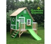
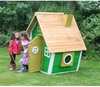
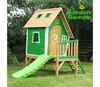
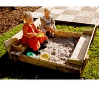
Garden Games Wooden Square Sandpit (1.2m Diameter)

Giant Garden Games: Wooden Square Sandpit (1.2m Diameter) Without a doubt, the most popular piece of play equipment enjoyed by all young children is a sandpit. At 1.2m (4ft) square, this sandpit is big enough to share but small enough not to take over the garden. The built-in cover folds open to provide two simple bench seats, removing the need for a separate lid or cover, Includes geo textile underlay. Some drilling required
RIP - This product is no longer available on our network. It was last seen on 26.10.2016

This page now acts as a permanent archive for this product. Add more information using the comments box below to ensure it can still be found by future generations.

Use our search facility to see if it is available from an alternative contributor.
  • Availability: Out Of Stock
  • Supplier: All Outdoor
  • SKU: 1054
Availability: In Stock
£92.40

Product Description

Giant Garden Games: Wooden Square Sandpit (1.2m Diameter) Without a doubt, the most popular piece of play equipment enjoyed by all young children is a sandpit. At 1.2m (4ft) square, this sandpit is big enough to share but small enough not to take over the garden. The built-in cover folds open to provide two simple bench seats, removing the need for a separate lid or cover,

Includes::
geo textile underlay. Some drilling required

Reviews/Comments

Add New

Intelligent Comparison

Oooops!
We couldn't find anything!
Perhaps this product's unique.... Or perhaps we are still looking for comparisons!
Click to bump this page and we'll hurry up.

Price History

Oooops!
We couldn't find any historical pricing!

Vouchers

No voucher codes found.
Do you know a voucher code for this product or supplier? Add it to Insights for others to use.

Facebook

Jargon Buster

Diameter - A measurement across a circle passing through the middle
Garden - An outside area with grass and foliage
Wooden - Something that is made from wood, from trees
garden - A planned space used for the display, cultivation and enjoyment of plants and other forms of nature.
Small - something that takes up less space than normal.
Equipment - A product or good that is tactile.
Simple - Basic, easy no difficulty in understanding.
Popular - Something that is admired and liked by many people.
Children - A young life form within the early stages of physical development,
Bench - Usually a long wooden chair found outdoors.

Supplier Information

Page Updated: 2015-05-01 04:03:15

Community Generated Product Tags

Oh No! The productWIKI community hasn't generated any tags for this product yet!
Menu