
 United Kingdom
 France
 Germany
 Netherlands
 Sweden
 USA
USA
 Italy
Italy
 Spain
Spain
More From Contributor


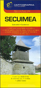
Secuimea
Secuimea on an indexed road map at 1:250, 000 from Cartographia, providing coverage of central and eastern parts of Transylvania, from Cluj Napoca and Alba Iulia eastward, with coverage extending south to Sibiu and Brasov. The map has contours at 100m

Product Description
Reviews/Comments
Add New
Vouchers
No voucher codes found.
Do you know a voucher code for this product or supplier? Add it to Insights for others to use.
Do you know a voucher code for this product or supplier? Add it to Insights for others to use.
 Denmark