
 United Kingdom
 France
 Germany
 Netherlands
 Sweden
 USA
USA
 Italy
Italy
 Spain
Spain
More From Contributor


Dominica
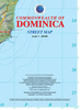
Dominica in a series of tourist maps of the Caribbean islands from the Barbados-based Skyview Inc combining a map of the island, enlargements of Roseau and Portsmouth, and extensive tourist information on various services and facilities.Rather than providing conventional mapping with topography, detailed road network, etc., Skyview maps give a more generalize picture of main roads and access to the numerous facilities highlighted on their maps. The main map covers the whole island, highlighting locations of beaches and diving sites, bird and dolphin watching sites, horse riding stables, Agro Tours, Pirates of the Caribbean film sites, etc. The map and enlargements showing in greater detail Roseau and Portsmouth are annotated with colour coded icons cross-referenced to the
information on the reverse listing locations of over fifty selected services, grouped into accommodation, restaurants and bars, shopping and services, car hire, hiking points and trails, health/spa/wellness, land and sea activities, plus other interest.
information on the reverse listing locations of over fifty selected services, grouped into accommodation, restaurants and bars, shopping and services, car hire, hiking points and trails, health/spa/wellness, land and sea activities, plus other interest.
Product Description
Reviews/Comments
Add New
Intelligent Comparison
Archived Product

Dominica Stanfords
£13.99
Archived Product

Dominic Stanfords
£8.99
Archived Product
Dominion Stanfords
£18.99
Archived Product

Dominion Stanfords
£8.99
Vouchers
No voucher codes found.
Do you know a voucher code for this product or supplier? Add it to Insights for others to use.
Do you know a voucher code for this product or supplier? Add it to Insights for others to use.
 Denmark