
 United Kingdom
 France
 Germany
 Netherlands
 Sweden
 USA
USA
 Italy
Italy
 Spain
Spain
More From Contributor


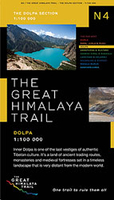
Dolpa
Dolpa region in the Newgrove Consultants’ series covering the course of Great Himalaya Trail High Route at 1:100, 000 on nine maps printed on light, waterproof and tear-resistant plastic paper. The map is double-sided, with a very generous overlap between the sides, and covers the GHT High Route between Nengla Bhanjyang in the Shey-Phoksundo National Park and Muktinath on the Annapurna Circuit. The base map, derived from satellite imagery, has contours at 200m intervals enhanced by relief shading and colouring to show glaciers, the snow line at 6000m, barren land, forests, etc. Numerous spot heights are marked in the high-laying areas, but not very many and in places none on the south side of the trail. Important peaks and mountain passes are prominently marked. Boundaries of
national parks and other protected areas are also shown.The High Route of the GHT is clearly highlighted and adjoining local routes are divided into main trails and footpaths. Icons indicate locations of campsites and hotels/lodges, health posts, stupas, gompas and mani walls both along the GHT itself and in other locations on the map. Settlements are graded into large towns, towns, villages and small villages. The maps have latitude and longitude lines at intervals of 5’. All information is in English.Seven of the maps are double-sided, with the last three maps covering the easternmost part of the country from Rolwaling Himal and Mt Everest to Kanchenjunga on single-sided maps. PEASE NOTE: Sheet No. 1, Far West, covers an area outside the course of the High Route. It shows the
route of the Lower Great Himalaya Trail. According to the publishers’ notes: “The maps have been created and published by Newgrove Consultants on behalf of The Great Himalaya Trail Development Programme which is funded by the UK Department for International Development and managed by SNV Netherland’s Development Organization. United Nations World Tourism Organization through its “Sustainable Tourism – Eliminating Poverty” programme ahs played a key role in bringing the project into fruition. The maps are based on data from the National Geographic Information Infrastructure Programme (NGIIP) of Nepal. The International Centre for Integrated Mountain Development (ICIMOD) also provided low scale data. Trekkers and guides have been consulted on current routes.”

Product Description
Reviews/Comments
Add New
Vouchers
No voucher codes found.
Do you know a voucher code for this product or supplier? Add it to Insights for others to use.
Do you know a voucher code for this product or supplier? Add it to Insights for others to use.
 Denmark