More From Contributor

£10.99
Dolomiti del Centro Cadore area in a series of Tabacco maps at 1:25, 000 covering the Dolomites & the mountains of north-eastern Italy
- Stanfords’ most popular coverage for this region, with excellent cartography & extensive overprint for hiking routes & other recreational activities, local bus stops, etc. Additional overprint in this title shows cycle & ski routes. To see the list of titles in this series please click on the series link. Maps in the Tabacco 25K series have contours at 25m intervals, shading & graphic relief to provide a vivid picture of the topography. An overprint highlights local footpaths as well as long-distance trails including all the Alte Vie (the Dolomites high level routes), indicating the degree of difficulty, the state of waymarking, & the ”via ferrata” sections. Most titles now also highlight cycling routes & mountain bike trails; some also include ski routes. Six different types of accommodation are marked, from isolated hotels & inns to campsites & refuges, local bus stops, cable car lines & chair lifts, plus places of interest & sport facilities. Unless indicated to the contrary in the individual description, the maps have a 1km UTM grid & the map legend

Includes::
English.


...
Archived Product
£10.99
Dolomiti di Auronzo e del Comelico area in a series of Tabacco maps at 1:25, 000 covering the Dolomites & the mountains of north-eastern Italy
- Stanfords’ most popular coverage for this region, with excellent cartography & extensive overprint for hiking routes & other recreational activities, local bus stops, etc. Additional overprint in this title shows cycle & ski routes. To see the list of titles in this series please click on the series link. Maps in the Tabacco 25K series have contours at 25m intervals, shading & graphic relief to provide a vivid picture of the topography. An overprint highlights local footpaths as well as long-distance trails including all the Alte Vie (the Dolomites high level routes), indicating the degree of difficulty, the state of waymarking, & the ”via ferrata” sections. Most titles now also highlight cycling routes & mountain bike trails; some also include ski routes. Six different types of accommodation are marked, from isolated hotels & inns to campsites & refuges, local bus stops, cable car lines & chair lifts, plus places of interest & sport facilities. Unless indicated to the contrary in the individual description, the maps have a 1km UTM grid & the map legend

Includes::
English.


...
Archived Product
£7.95
Map No. 145, Dolomiti di Braies
- Pragser Dolomiten at 1:25, 000 printed on sturdy waterproof & tear-resistant plastic paper.
...
Archived Product
£10.99
Dolomiti di Braies/ Pragser Dolomiten
- Marebbe/ Ennberg area in a series of Tabacco maps at 1:25, 000 covering the Dolomites
...
Archived Product
£10.50
Map No. 073, Dolomiti di Brenta, from Kompass in a series providing detailed coverage of the Dolomites & Lake Garda area & supplementing their main series of walking maps of Italy at 1:50, 000. Maps in this series have a more detailed base & smaller contour interval than coverage at 1:50, 000. Cartography: maps at 1:25, 000 have contours at 25-m intervals. An overprint shows local & long-distance footpaths, including all the high level routes (Alte Vie). The maps also show the via ferrata paths along the iron rails & ladders fitted into the rock faces. Other information

Includes::
various types of accommodation (campsites, alpine huts & refuges, etc.), recreational facilities, places of interest, local bus stops, etc. Many titles also have mountain bike trails or ski routes. Selected titles include on the reverse panorama drawings of the area, as indicated in the individual descriptions. Geographical coordinates: this title has no geographical coordinates. Map legend

Includes::
English.PLEASE NOTE BEFORE ORDERING! Booklets: many titles come with booklets describing the area and/or various hiking routes. These booklets are in Italian & German only, apart from a handful of titles where an English language booklet is specifically indicated in the individual description. So, unless English language booklet is actually mentioned, the map can only be supplied with an Italian/ German booklet. These booklets are not necessary to use the maps since, as stated above, full English language map legend is provided.


...
Archived Product
£11.99
La Gruppo di Brenta
- Madonna di Campiglio
- Andalo – Molveno area at 1:25, 000 from Kompass in their series of detailed maps

...
Archived Product
£13.99
Map No. 073, Dolomiti di Brenta, from Kompass in a series providing detailed coverage of the Dolomites & Lake Garda area & supplementing their main series of walking maps of Italy at 1:50, 000. Maps in this series have a more detailed base & smaller contour interval than coverage at 1:50, 000.* Cartography:* maps at 1:25, 000 have contours at 25-m intervals. An overprint shows local & long-distance footpaths, including all the high level routes (Alte Vie). The maps also show the ”via ferrata” paths along the iron rails & ladders fitted into the rock faces. Other information

Includes::
various types of accommodation (campsites, alpine huts & refuges, etc.), recreational facilities, places of interest, local bus stops, etc. Many titles also have mountain bike trails or ski routes. Selected titles include on the reverse panorama drawings of the area, as indicated in the individual descriptions.* Geographical coordinates:* this title has no geographical coordinates.* Map legend

Includes::
English.**PLEASE NOTE BEFORE ORDERING!* * Booklets:* many titles come with booklets describing the area and/or various hiking routes. These booklets are in * Italian & German only*, apart from a handful of titles where an English language booklet is specifically indicated in the individual description. So, unless English language booklet is actually mentioned, the map can only be supplied with an Italian/ German booklet. These booklets are not necessary to use the maps since, as stated above, full English language map legend is provided.


...
Archived Product
£7.95
Map No. 073, Dolomiti di Brenta, from Kompass in a series providing detailed coverage of the Dolomites & Lake Garda area & supplementing their main series of walking maps of Italy at 1:50, 000. Maps in this series have a more detailed base & smaller contour interval than coverage at 1:50, 000. Cartography: maps at 1:25, 000 have contours at 25-m intervals. An overprint shows local & long-distance footpaths, including all the high level routes (Alte Vie). The maps also show the via ferrata paths along the iron rails & ladders fitted into the rock faces. Other information

Includes::
various types of accommodation (campsites, alpine huts & refuges, etc.), recreational facilities, places of interest, local bus stops, etc. Many titles also have mountain bike trails or ski routes. Selected titles include on the reverse panorama drawings of the area, as indicated in the individual descriptions. Geographical coordinates: this title has no geographical coordinates. Map legend

Includes::
English.PLEASE NOTE BEFORE ORDERING! Booklets: many titles come with booklets describing the area and/or various hiking routes. These booklets are in Italian & German only, apart from a handful of titles where an English language booklet is specifically indicated in the individual description. So, unless English language booklet is actually mentioned, the map can only be supplied with an Italian/ German booklet. These booklets are not necessary to use the maps since, as stated above, full English language map legend is provided.


...
Archived Product
£10.99
Dolomiti di Brenta area in a series of Tabacco maps at 1:25, 000 covering the Dolomites & the mountains of north-eastern Italy
-
...
Archived Product
£11.99
Map No. 625, Dolomiti di Sesto/ Sextener Dolomiten, at 1:25, 000 from Kompass printed on sturdy, waterproof & tear-resistant synthetic paper in a series providing detailed coverage of the Dolomites & the Lake Garda area. Maps in this series supplement the publishers` main series of walking maps of Italy at 1:50, 000 & have a more detailed base & smaller contour interval than coverage at 1:50, 000.* Cartography:* maps at 1:25, 000 have contours at 25-m intervals. An overprint shows local & long-distance footpaths, including all the high level routes (Alte Vie). The maps also show the ”via ferrata” paths along the iron rails & ladders fitted into the rock faces. Other information

Includes::
various types of accommodation (campsites, alpine huts & refuges, etc.), recreational facilities, places of interest, local bus stops, etc. Many titles also have mountain bike trails or ski routes. Selected titles include on the reverse panorama drawings of the area, as indicated in the individual descriptions.* Geographical coordinates:* most maps are now GPS compatible
- titles without geographical coordinates are annotated to that effect in their individual description.* Map legend

Includes::
English.**PLEASE NOTE BEFORE ORDERING!* * Booklets:* many titles come with booklets describing the area and/or various hiking routes. These booklets are in * Italian & German only*, apart from a handful of titles where an English language booklet is specifically indicated in the individual description. So, unless English language booklet is actually mentioned, the map can only be supplied with an Italian/ German booklet. These booklets are not necessary to use the maps since, as stated above, full English language map legend is provided.


...
Archived Product

Dolomiti Di Brenta - Adamello - Presanella - Val Di Sole

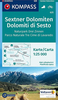
One of the titles in a series of hiking maps with contours at 50m intervals, shading and graphic relief. An overprint highlights local footpaths, including the high level long-distance routes (Alte Vie), indicating difficult sections. The maps also show the via ferrata paths along the iron rails and ladders fitted into the rock faces during the World War II to improve troop movement and now open to the public. Different types of accommodation, cable car lines, chair lifts, and various places of interest are also marked. The maps have no geographical coordinates. Map legend is in Italian and German only, unless it is indicated in the individual description that English is included.In this title map legend includes English.
RIP - This product is no longer available on our network. It was last seen on 25.09.2019

This page now acts as a permanent archive for this product. Add more information using the comments box below to ensure it can still be found by future generations.

Use our search facility to see if it is available from an alternative contributor.
  • Availability: Out Of Stock
  • Supplier: Stanfords
  • SKU: 9788883150463
Availability: In Stock
£7.95

Product Description

One of the titles in a series of hiking maps with contours at 50m intervals, shading & graphic relief. An overprint highlights local footpaths, including the high level long-distance routes (Alte Vie), indicating difficult sections. The maps also show the via ferrata paths along the iron rails & ladders fitted into the rock faces during the World War II to improve troop movement & now open to the public. Different types of accommodation, cable car lines, chair lifts, & various places of interest are also marked. The maps have no geographical coordinates. Map legend is in Italian & German only, unless it is indicated in the individual description that English is included. In this title map legend

Includes::
English.

Reviews/Comments

Add New

Intelligent Comparison

Oooops!
We couldn't find anything!
Perhaps this product's unique.... Or perhaps we are still looking for comparisons!
Click to bump this page and we'll hurry up.

Price History

Vouchers

No voucher codes found.
Do you know a voucher code for this product or supplier? Add it to Insights for others to use.

Facebook

Jargon Buster

Hiking - An outdoor activity envolving walking in nature
Italian - A word used ot descibe something from Italy
iron - An electrical deviced used for removing creases from fabrics
iron - A chemical element (FE). The most common element on earth
Cable - A series of wires bonded to form a single thread
World - A physical grouping, commonly used to describe earth and everything associated with ti
Car - A machine used for transport which runs on roads
Sole - The bottom of a shoe.
Accommodation - A room in which someone can live in, for example in a hotel
Individual - A single separate item or person.

Supplier Information

Stanfords
Stanfords was established in 1853 and opened their iconic Covent Garden flagship store in 1901. They have become the top retailer of maps, travel books and accessories in the UK and arguably offer the largest selection of maps and travel books worldwide. Famous names such as Captain Robert Falcon Scott, Ranulph Fiennes and Michael Palin have purchased from Stanfords. They now have a shop in Bristol and both stores together with other venues operate a calendar of events including talks, book signings and exhibitions. As a specialist map retailer, the map selection is comprehensive and includes road maps, street maps and walking maps from worldwide destinations, as well as a selection of world atlases and wall maps. Books include travel guides and travel literature. Stanfords also stock globes, from miniatures made of blue marble to magnificent floor-standing globes. The website features a selection of interesting articles on travel topics.
Page Updated: 2023-11-12 20:15:36

Community Generated Product Tags

Oh No! The productWIKI community hasn't generated any tags for this product yet!
Menu