More From Contributor
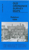
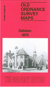
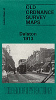
£9.50
Indexed, waterproof & tear-resistant road map of the Croatian coast & its islands with topographic & tourist information, published ...
Archived Product
£7.95
Dalmatian Coast South: Dubrovnik
- Kotor
- Ulcinj in a series of three detailed, double-sided maps at 1:100, 000 from Kompass,

...
Archived Product
£14.99
Waterproof & tear-resistant OS Active version of map No. 77 from the Ordnance Survey’s Landranger series at 1:50, 000, with contoured ...
Archived Product
£8.99
Paper version of map No. 77 from the Ordnance Survey’s Landranger series at 1:50, 000, with contoured & GPS compatible topographic ...
Archived Product
£19.99
The southern part of Sweden in a series of 30 double-sided cycling maps from Norstedts printed on light, waterproof & tear-resistant ...
Archived Product
£3.50
Dalston in 1894 in a fascinating series of reproductions of old Ordnance Survey plans in the Alan Godfrey Editions, ideal for anyone ...
Archived Product
£3.50
Dalston in 1913 in a fascinating series of reproductions of old Ordnance Survey plans in the Alan Godfrey Editions, ideal for anyone ...
Archived Product
£14.99
In Dilraj Mann`s long awaited graphic novel debut, all eyes turn to East London, where freakish monsters & megalomanical property ...
Archived Product
£18.99
A STORY OF CORRUPTION, EGO, GREED
- & ONE TERRIBLE MISJUDGMENT. In this jaw-dropping expose, Oliver Shah uncovers the truth
...
Archived Product
£13.99
Damaraland in Namibia at 1:430, 000 on a road map from the South African publishers International Motoring Productions, annotated ...
Archived Product

Dalston 1870

Dalston in 1870 in a fascinating series of reproductions of old Ordnance Survey plans in the Alan Godfrey Editions, ideal for anyone interested in the history of their neighbourhood or family. Three versions of this map cover the same area, stretching
RIP - This product is no longer available on our network. It was last seen on 25.09.2019

This page now acts as a permanent archive for this product. Add more information using the comments box below to ensure it can still be found by future generations.

Use our search facility to see if it is available from an alternative contributor.
  • Availability: Out Of Stock
  • Supplier: Stanfords
  • SKU: 9780850541991
Availability: In Stock
£3.50

Product Description

Dalston in 1870 in a fascinating series of reproductions of old Ordnance Survey plans in the Alan Godfrey Editions, ideal for anyone interested in the history of their neighbourhood or family. Three versions of this map cover the same area, stretching from Essex Road eastward to London Fields, & from Shacklewell Lane southward to De Beauvoir Crescent; a varied & very busy area, comprising De Beauvoir Town, Kingsland & Balls Pond at the west, Dalston & west Hackney to the east. The North London Railway forms a T-shape across the map, including Dalston Junction & Haggerston stations, while on the later maps the GER line runs down the eastern side, including London Fields & Hackney Downs stations. Kingsland Road & Kingsland High Street run north-south through the centre of the map. Other features include De Beauvoir Square, Kingsland Basin, Bricklayers Almshouses, Dyers Almshouses, Balls Pond Road, Mildmay Compound, German Hospital, Militia Barracks, etc. About the Alan Godfrey Editions of the 25” OS Series: Selected towns in Great Britain & Ireland are covered by maps showing the extent of urban development in the last decades of the 19th & early 20th century. The plans have been taken from the Ordnance Survey mapping & reprinted at about 15 inches to one mile (1:4, 340). On the reverse most maps have historical notes & many also include extracts from contemporary directories. Most maps cover about one mile (1.6kms) north/south, one & a half miles (2.4kms) across; adjoining sheets can be combined to provide wider coverage.FOR MORE INFORMATION & A COMPLETE LIST OF ALL AVAILABLE TITLES PLEASE CLICK ON THE SERIES LINK.

Reviews/Comments

Add New

Price History

Vouchers

No voucher codes found.
Do you know a voucher code for this product or supplier? Add it to Insights for others to use.

Facebook

Jargon Buster

Contemporary - Modern era design
Contemporary - A design reference to indicate post war modern design
Pond - An area of water within a park or gardens
History - Anything that happens in the past. An acedemic subject.
Road - a manmade lane or a path that is used to speed up travel.
Contemporary - An object that is living in the same time.
Junction - A point where two or more things come together, typically used to describe roads
Ideal - Something that satisfies a perfect criteria.
Family - A group of people that live together made up from parents and children.

Supplier Information

Stanfords
Stanfords was established in 1853 and opened their iconic Covent Garden flagship store in 1901. They have become the top retailer of maps, travel books and accessories in the UK and arguably offer the largest selection of maps and travel books worldwide. Famous names such as Captain Robert Falcon Scott, Ranulph Fiennes and Michael Palin have purchased from Stanfords. They now have a shop in Bristol and both stores together with other venues operate a calendar of events including talks, book signings and exhibitions. As a specialist map retailer, the map selection is comprehensive and includes road maps, street maps and walking maps from worldwide destinations, as well as a selection of world atlases and wall maps. Books include travel guides and travel literature. Stanfords also stock globes, from miniatures made of blue marble to magnificent floor-standing globes. The website features a selection of interesting articles on travel topics.
Page Updated: 2023-11-12 20:15:36

Community Generated Product Tags

Oh No! The productWIKI community hasn't generated any tags for this product yet!
Menu