
 United Kingdom
 France
 Germany
 Netherlands
 Sweden
 USA
USA
 Italy
Italy
 Spain
Spain
More From Contributor


Alpe Di Siusi/Seiser Alpen
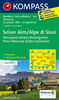
Map No. 067, Alpe di Siusi/Seiser Alpen - with a panorama map on the reverse, from Kompass in a series providing detailed coverage of the Dolomites and Lake Garda area and supplementing their main series of walking maps of Italy at 1:50, 000. Maps in
Product Description
Reviews/Comments
Add New
Intelligent Comparison
Archived Product

Alpe Di Siusi / Seiser Alpen Kompass 067 Stanfords
£9.99
Vouchers
No voucher codes found.
Do you know a voucher code for this product or supplier? Add it to Insights for others to use.
Do you know a voucher code for this product or supplier? Add it to Insights for others to use.
 Denmark